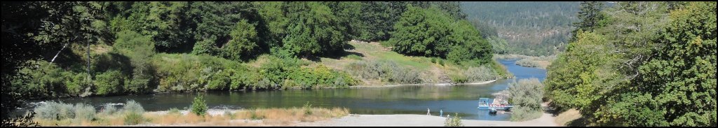
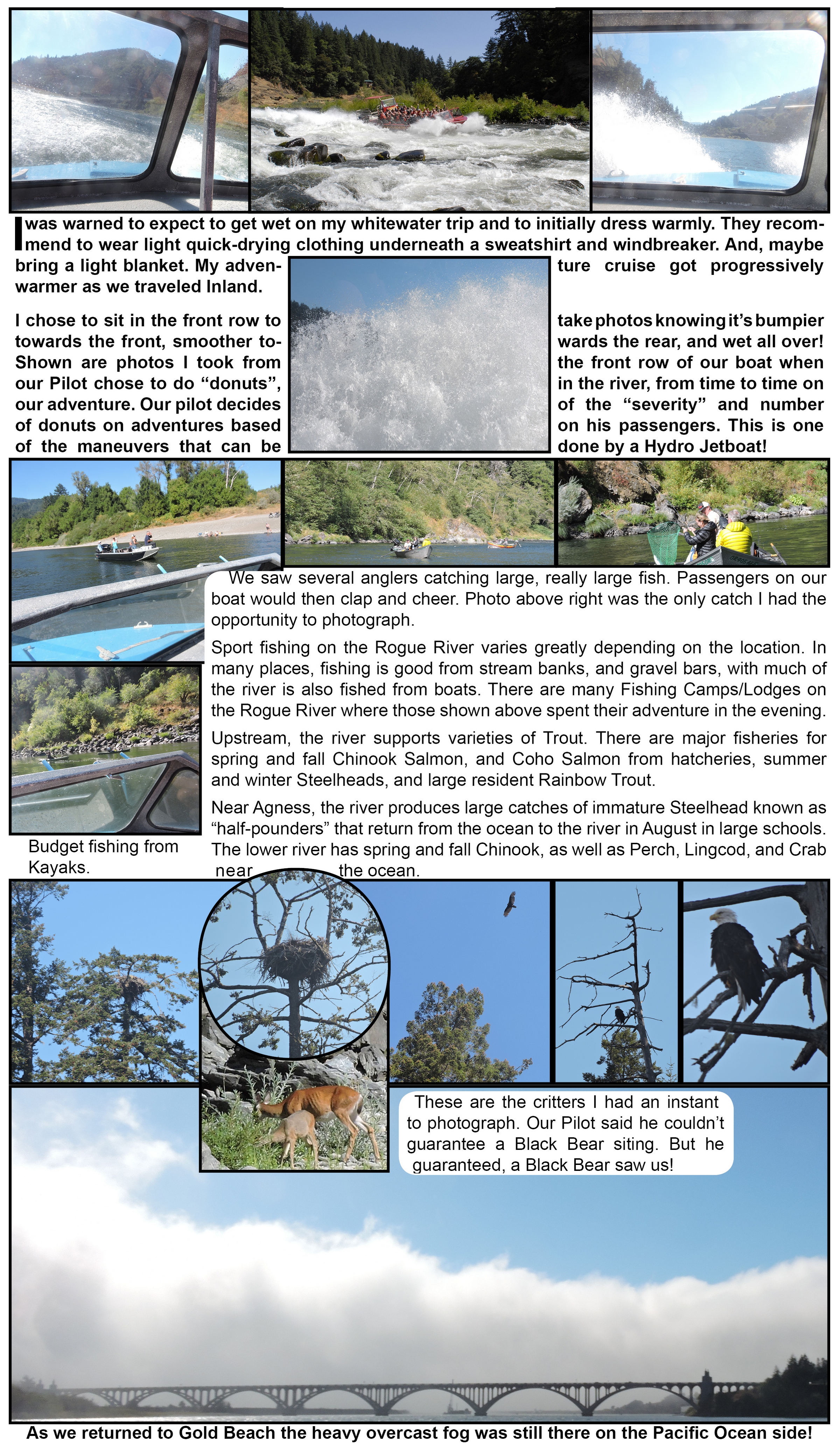
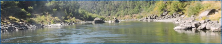
Photo of Rogue River taken from the Cougar Lane Lodge Deck at Agness.
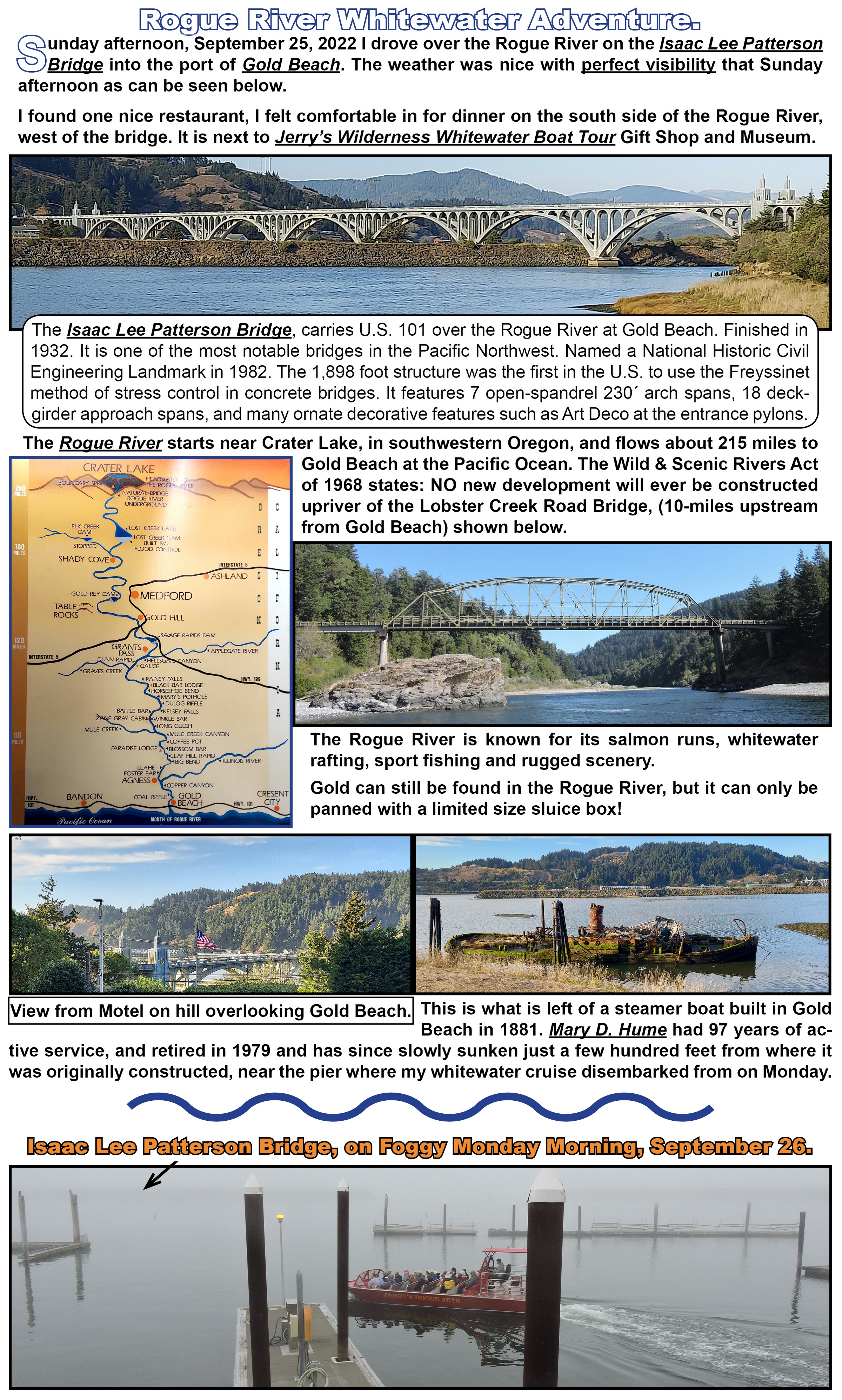
Sunday afternoon, September 25, 2022 I drove over the Rogue River on the Isaac Lee Patterson Bridge into the port of Gold Beach. The weather was nice with perfect visibility that Sunday afternoon as can be seen below.
I found one nice restaurant I felt comfortable in for dinner on the south side of the Rogue River, west of the bridge. It is next to Jerry’s Wilderness Whitewater Boat Tour Gift Shop and Museum.
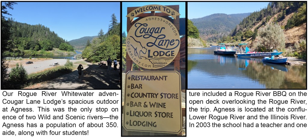
Rogue River Whitewater Adventure.
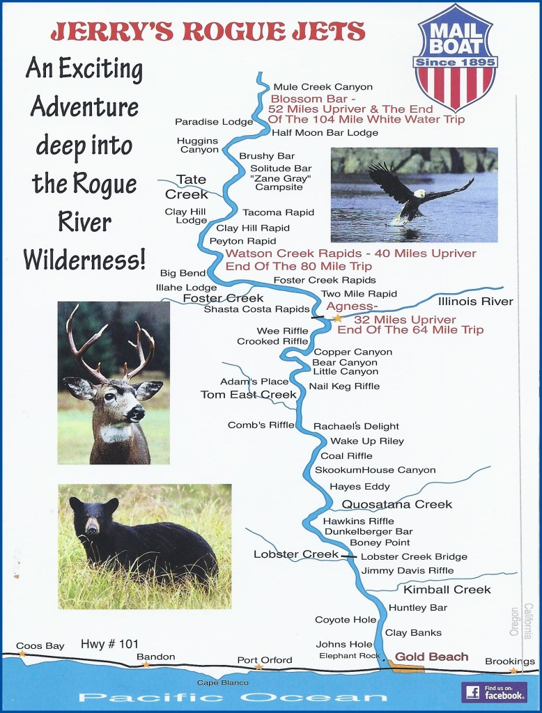
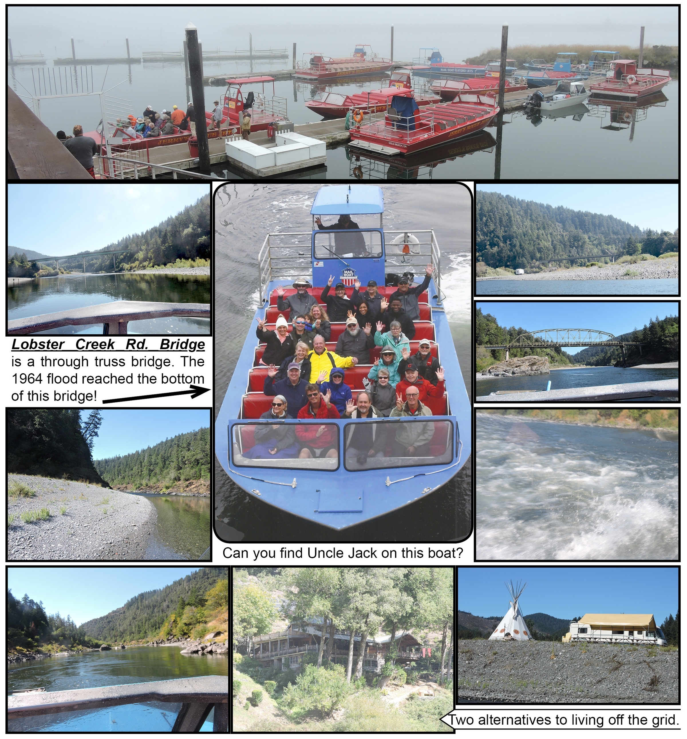
I had initially booked the 7 hour, 104 Mile white water round trip, thru the most beautiful section of the Wilderness zone which is only accessible by Hydro Jetboat of the Rogue-Siskiyou National Forest, to the Paradise Lodge. The lower Rogue River water level was too low to reach the Paradise Lodge in September, so I took the shorter 64 Mile round trip adventure to Agness. (The first cartographer misspelled “Agnes.” So, it has been spelled Agness, ever after. The Pilot of my boat named his daughter Agness!) The first mail boat was an 18 foot, double-ended craft made of cedar. By 1930, the mail-boat fleet consisted of three 26 foot boats, equipped with 60-horsepower Model A Ford engines and designed to carry 10 passengers. By the 1960s, rudderless Hydro Jetboats powered by 280-horsepower engines, began to replace propeller-driven boats. These Hydro Jetboats can safely negotiate shallow riffles, and the largest could carry nearly 50 passengers. As of 2010, Hydro Jetboats, functioning mainly as excursion craft, still deliver mail between Gold Beach and Agness. (The Rogue River mail boat company is one of only two mail carriers delivering the mail by boat in the United States.)
Click the below photo to view Uncle Jack’s next Oregon’s Coast Road Trip, from hisnext September, 2022 adventure.
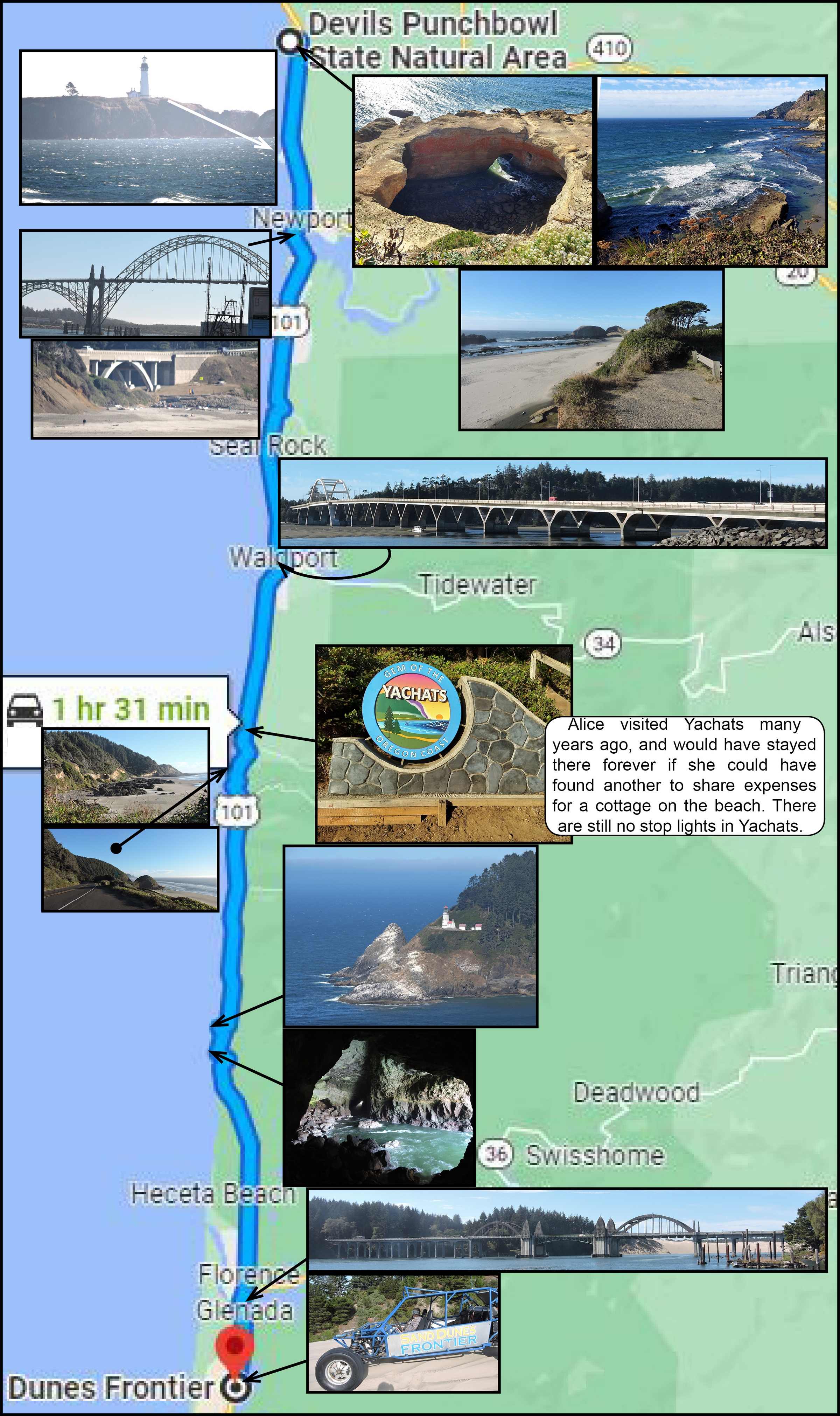
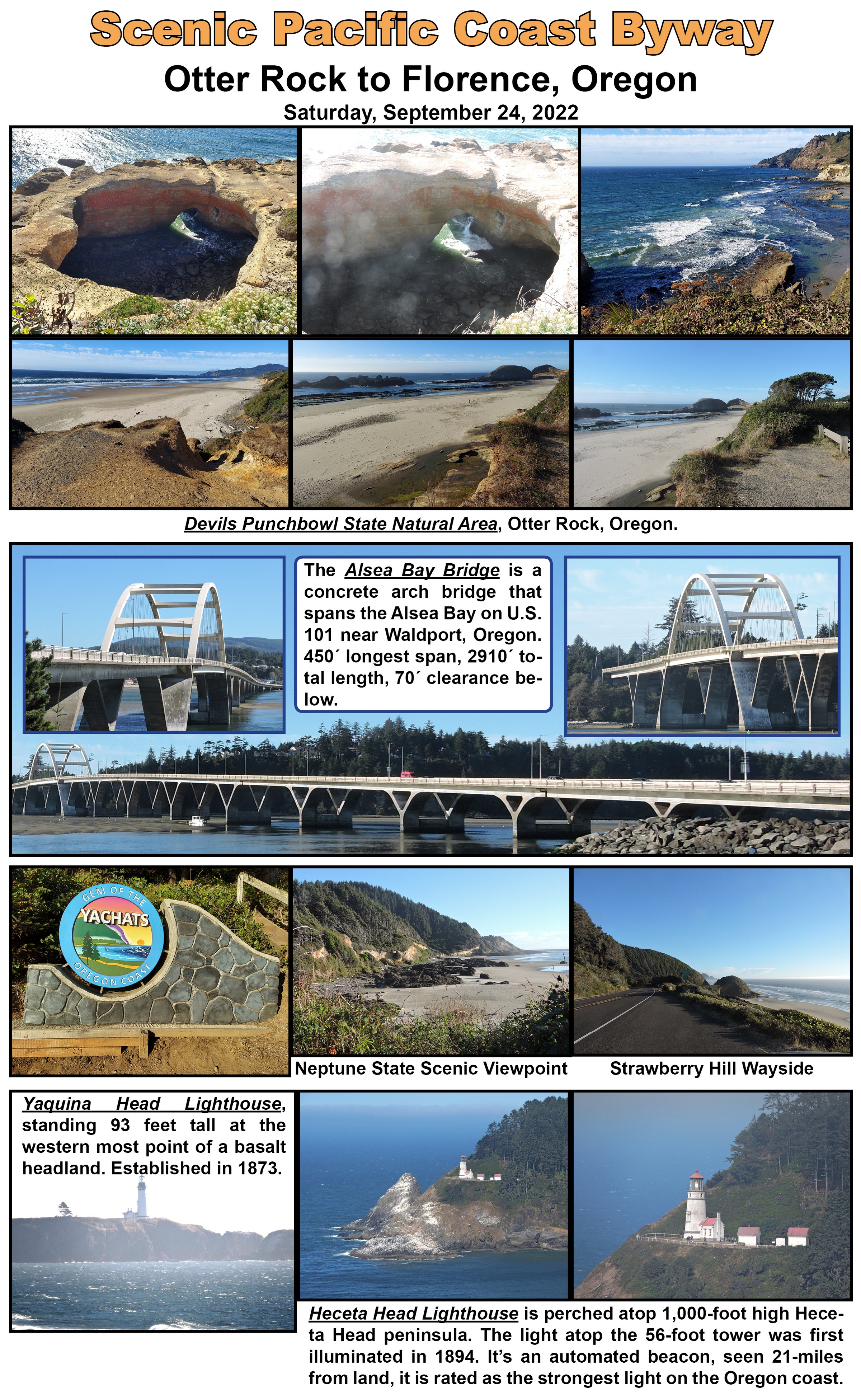
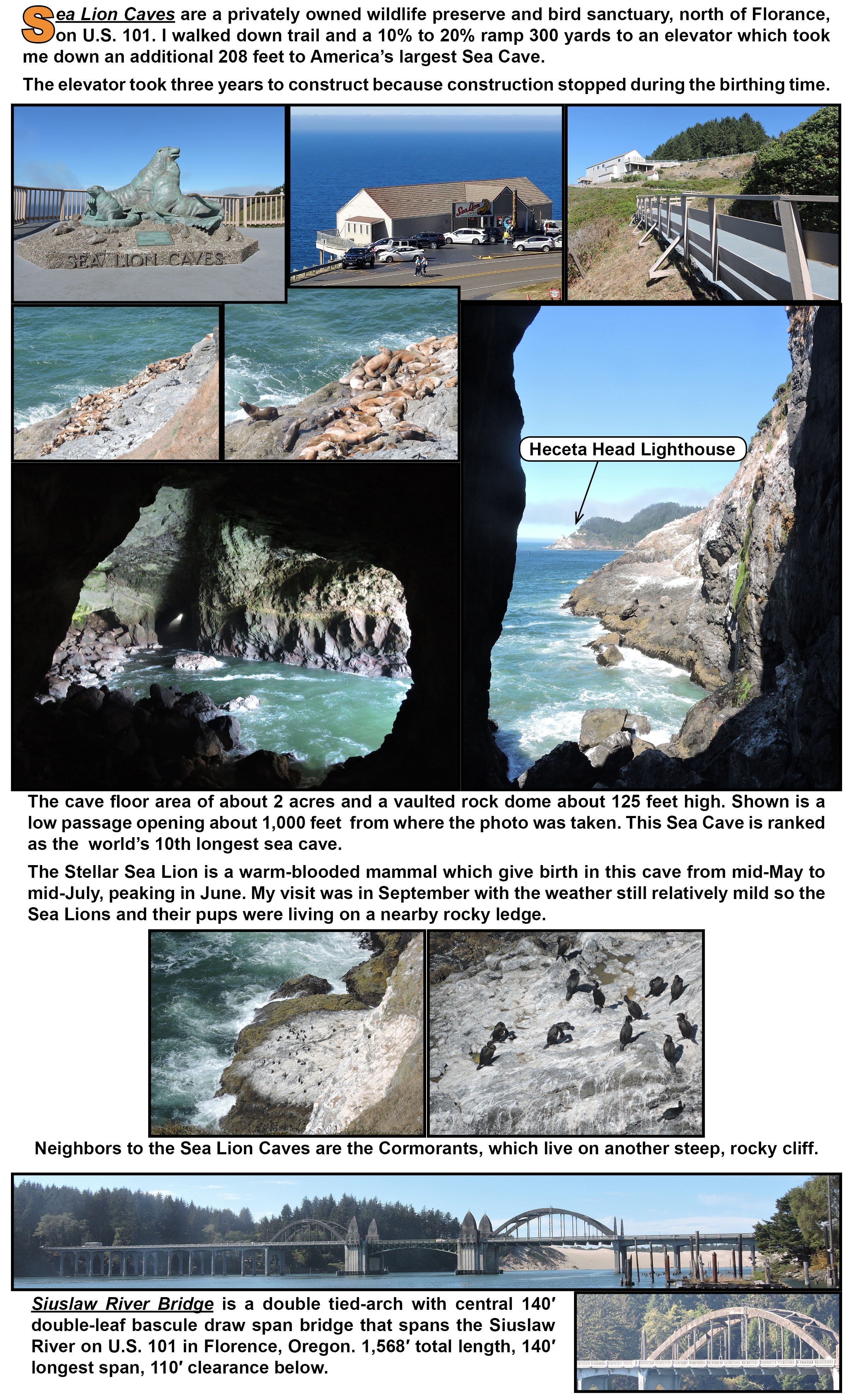
A Scenic Oregon Pacific Coast Byway road trip from Otter Rock, Oregon to Florence, Oregon on Saturday, September 24, 2022.
Road trip from Otter Rock, Oregon to Florence, Oregon.
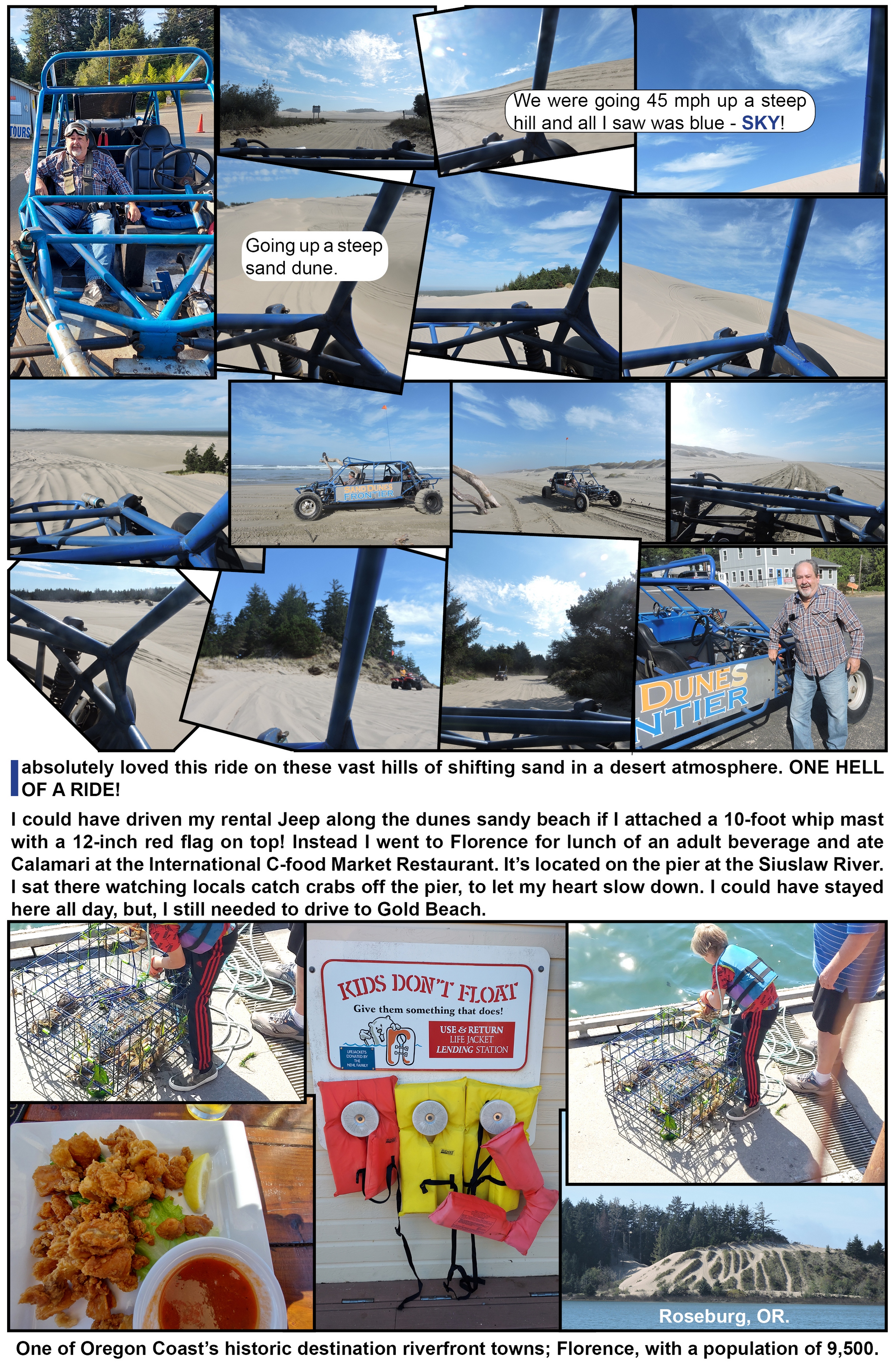
Sunday morning, September 25, 2022, while in the Oregon Dunes National Recreation Area within the Siuslaw National Forest, I was the first customer at Sand Dunes Frontier and I told the lady behind the desk I wanted to get a ride on one of those blue things! She said go climb in as my driver belted me in. This was a very heavy duty four point Safety Belt system like NASCAR’s five point system.
My driver said none of their drivers have ever rolled one of these Sand Sleds with a passenger on board!
Congress designated a 31,500-acre portion of the Siuslaw National Forest as the Oregon National Recreation Area in recognition of its unique values. There is an active program to remove evasive species that are a threat to the dunes ecosystem.
These are the Sand Dunes that inspired Frank Herbert’s science-fiction classic “Dune.”
These dunes can also be explored on foot, which include “sand board skiing.”
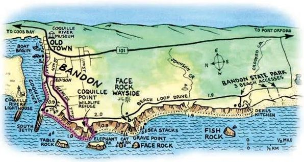
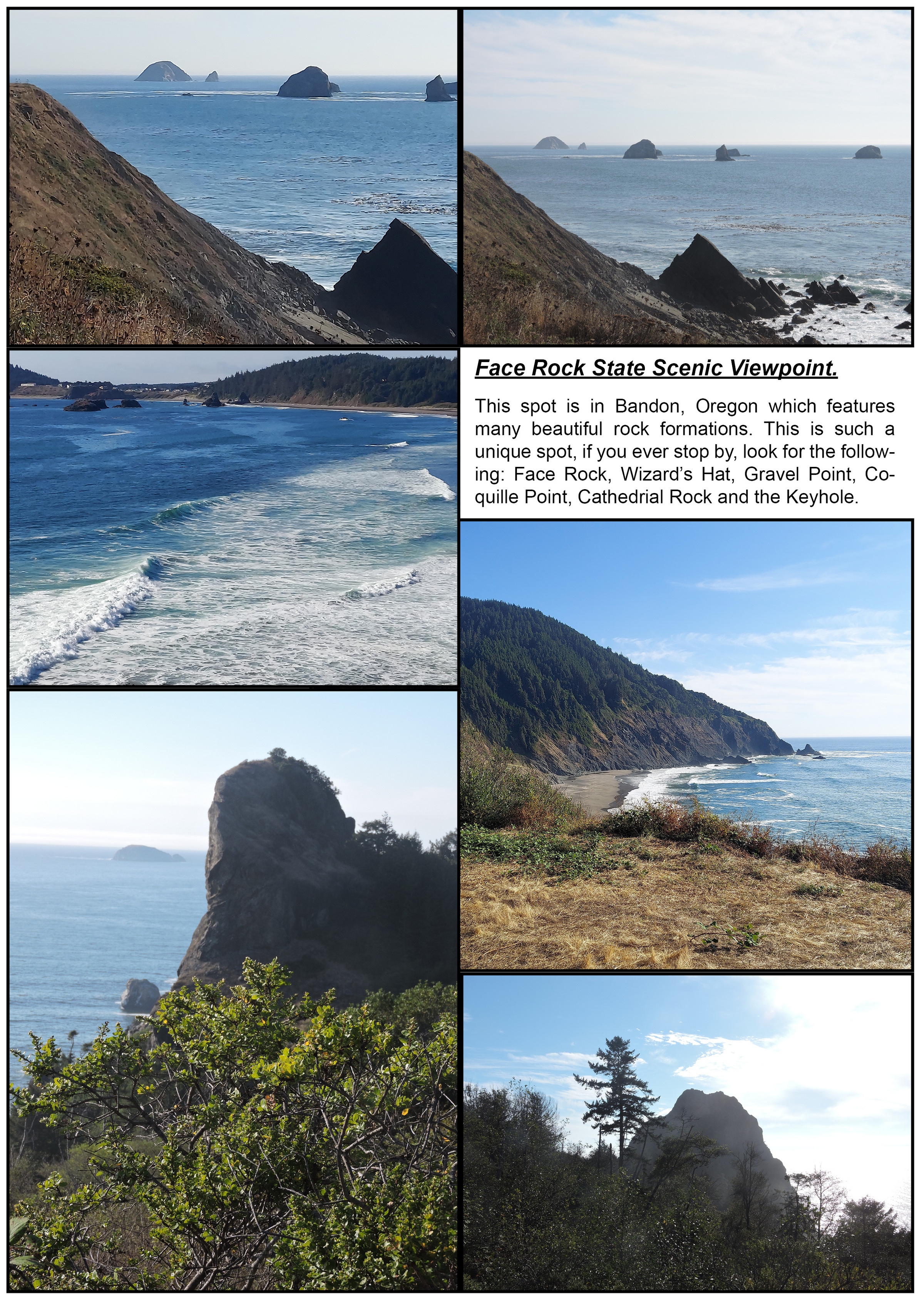
Beach Loop Road, Bandon, Oregon, Sunday, September 25, 2022.
Driving from Florence to Gold Beach I stopped at the Face Rock State Park and drove down the Beach Loop Road, just west of U.S. 101 to photograph its numerous rocky spires, offshore rock formations, and sandy beaches, with tide pools as well as an abundant number of sea birds and mammals. The Beach Loop Road offers access at several viewpoints. This five-mile drive/tour can take just a few minutes, or you can make it an all-day outing.
I spent too much time enjoying myself along the pier at the Siuslaw River in Florence and only stopped once along the Beach Loop Road, for half an hour.
Click one of the below photos of the Rogue River to view Uncle Jack’s next September, 2022 adventure.
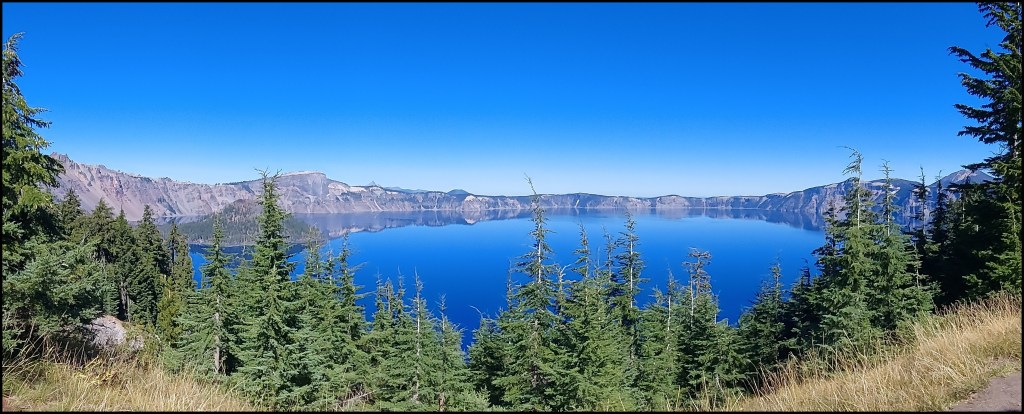
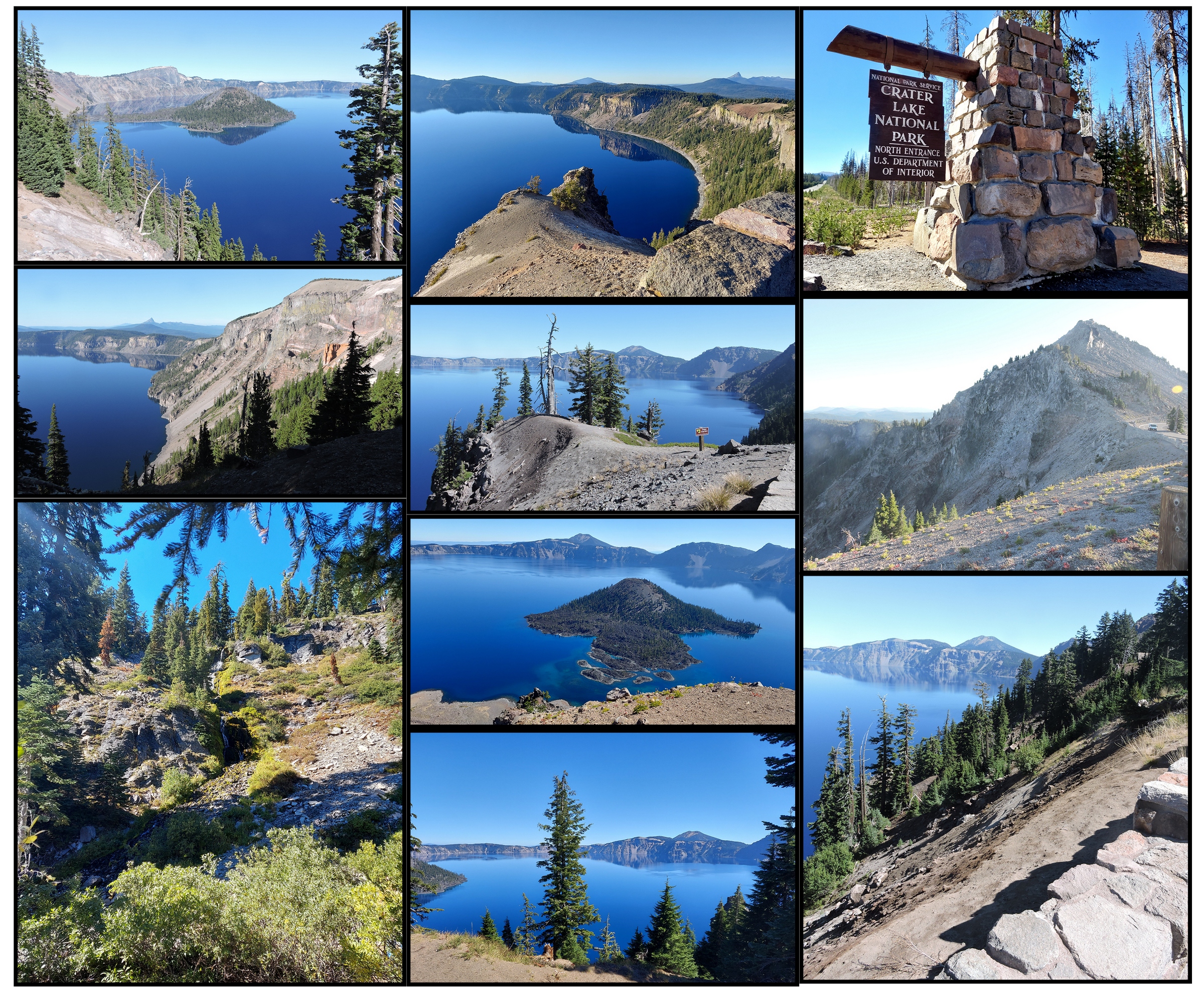
On Friday, September 23, 2022 I drove to the Crater Lake National Park from Cottage Grove. 20 square mile Crater Lake is in the Cascade Mountains of southern Oregon. It is known for its namesake Crater Lake, formed by the now-collapsed volcano, Mount Mazama. Wizard Island is a cinder cone near the western edge of the lake, which is another volcano in the volcano.
The lake is 1,949 feet deep which makes it the deepest lake in the United States, the second-deepest in North America and the ninth-deepest in the world.
Crater Lake has no streams flowing into or out of it. All water that enters the lake is eventually lost from evaporation or subsurface seepage. The lake is refilled entirely from direct precipitation in the form of snow and rain.
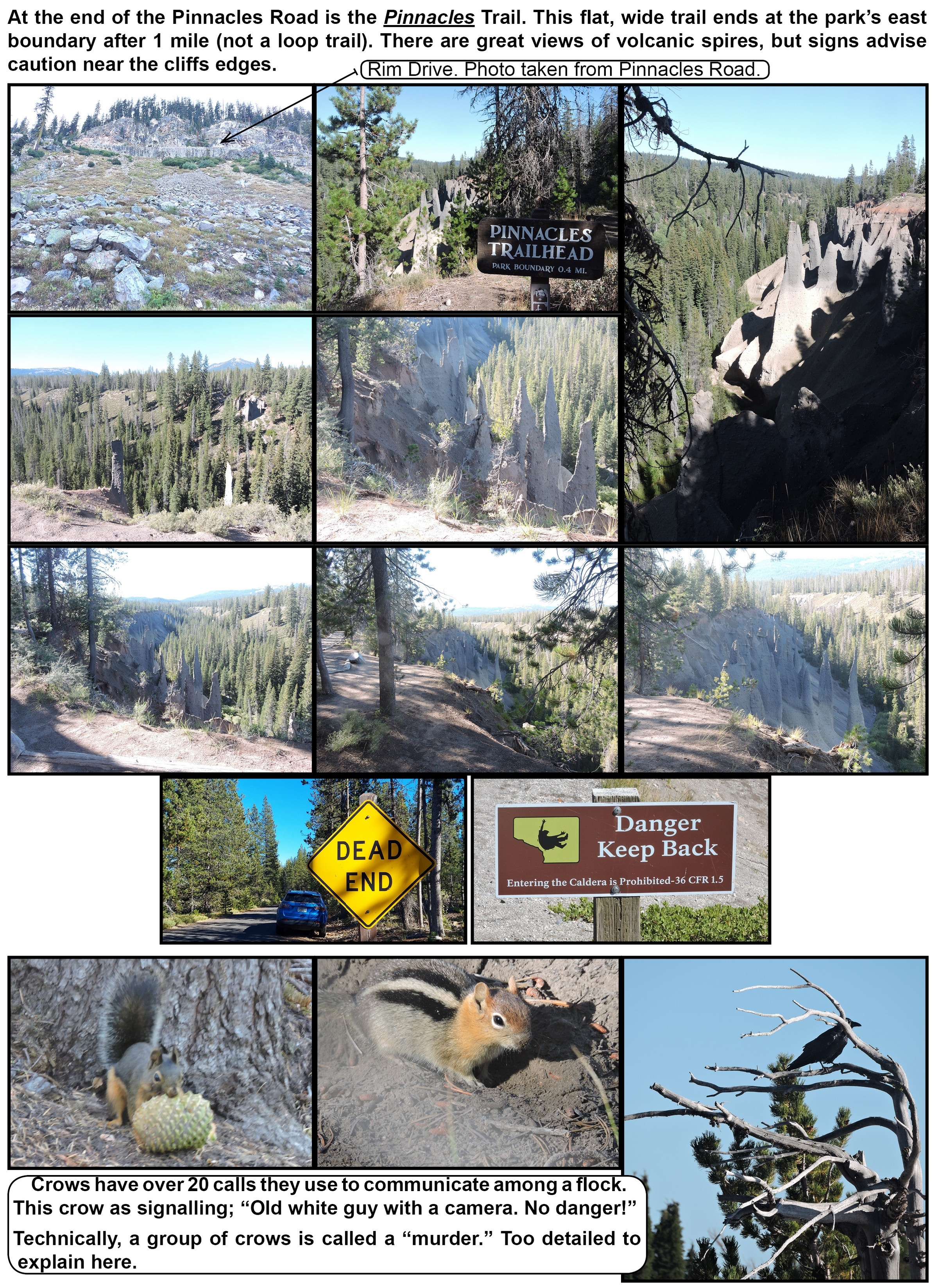
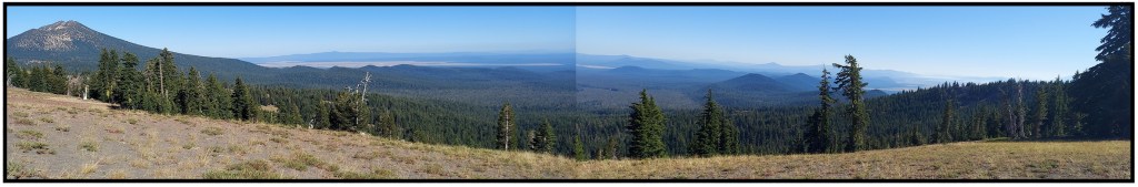
The 33 mile Rim Drive, a road surrounding the lake, offers 30 some overlooks of the park’s volcanic formations. I probably only stopped at half of them. The rim is around 2,000 feet above the lake.
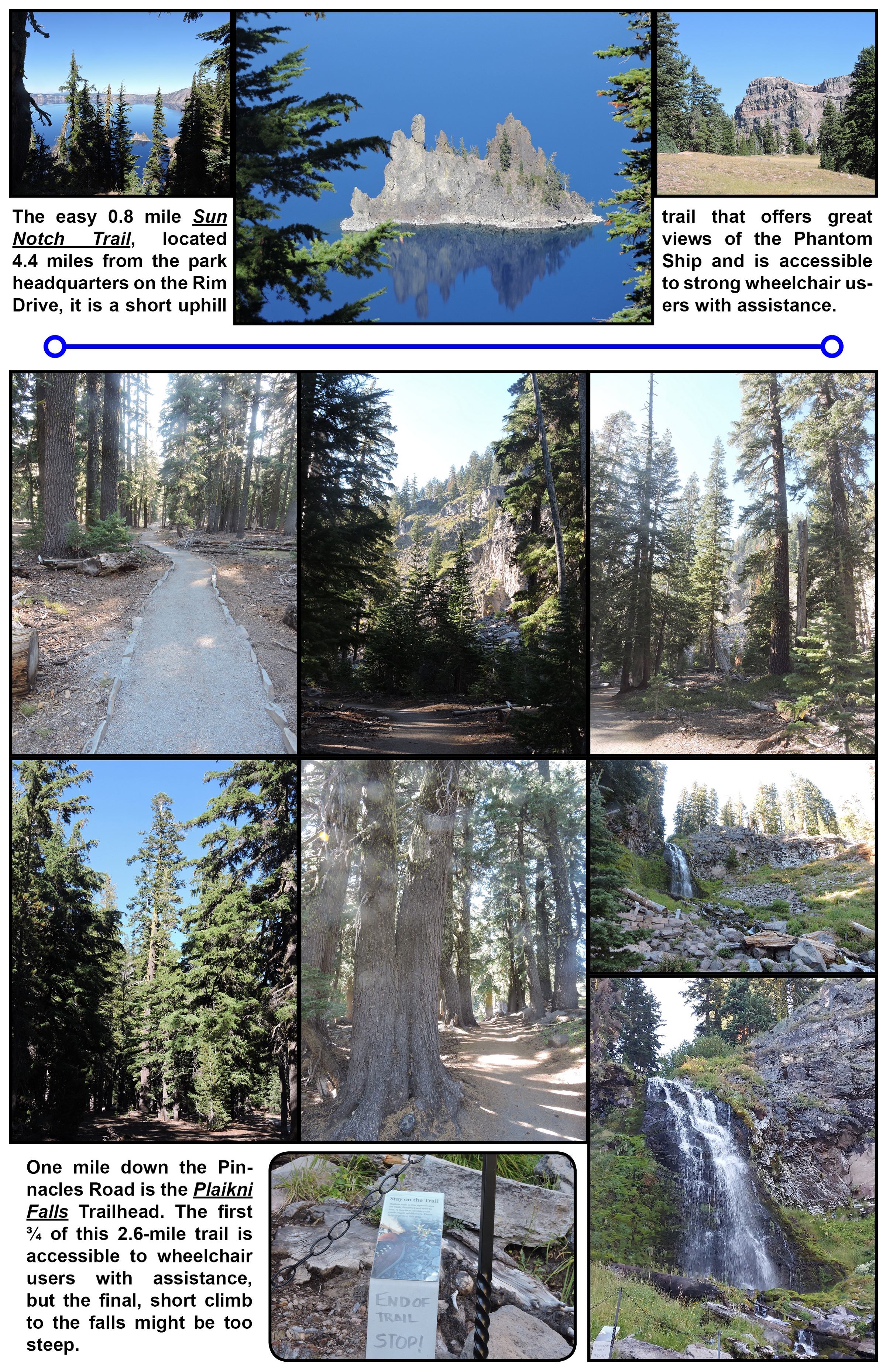
The park has numerous trails. I chose to include; The Sun Notch, with views of the “Phantom Ship,” a small island. Wheelchair accessible Plaikni Falls Trail and the must see Pinnacles Trail. And, the Vidae Falls which can be seen from your car.
Crater Lake’s rim is around 7,600 feet elevation above Roseburg, Oregon where I spent the night.
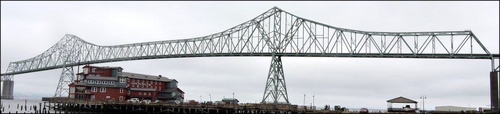
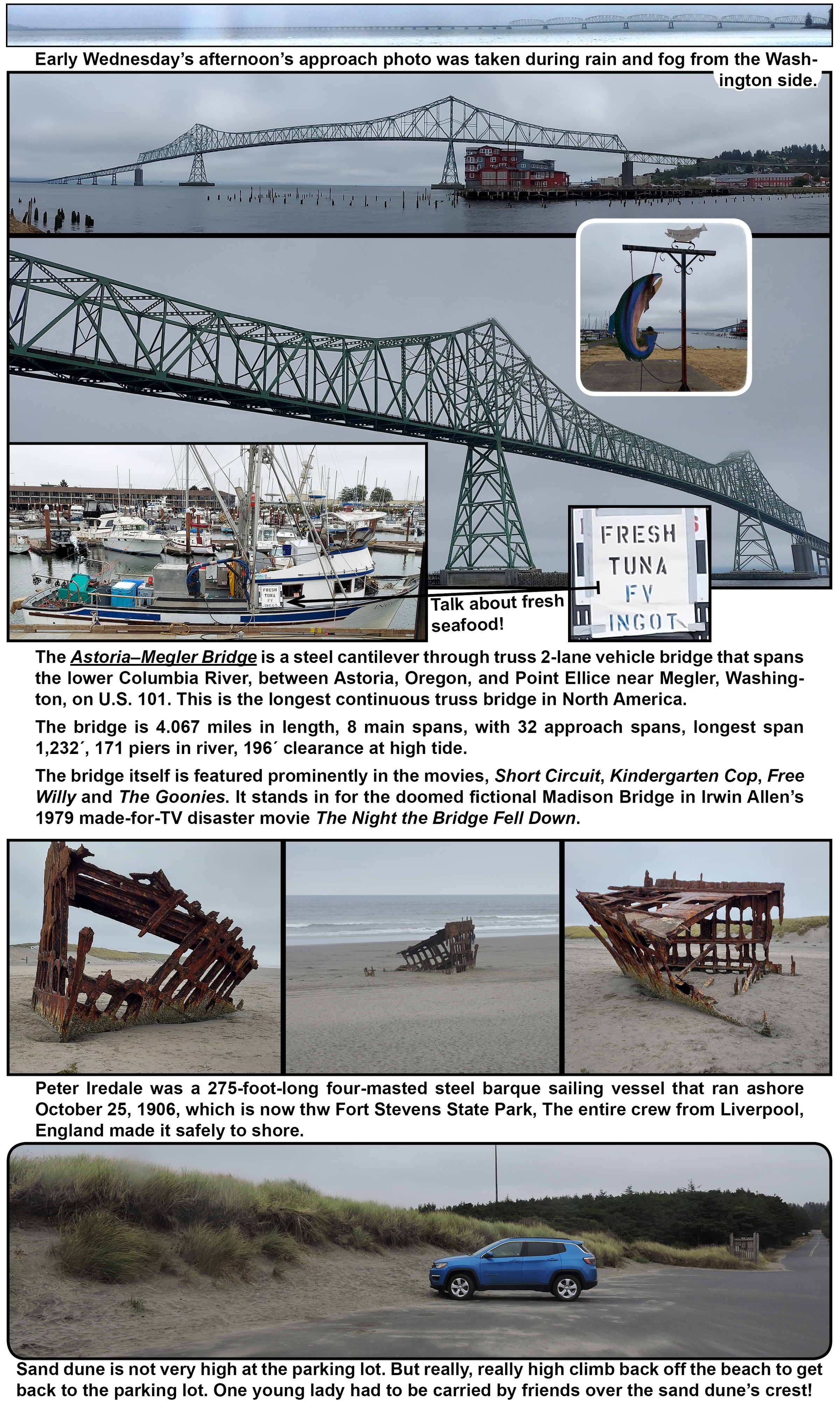
On Wednesday, September 21, 2022 I drove from the Olympic National Forest in Washington to Crater Lake National Park in Oregon with an overnight stay in Astoria, Oregon.
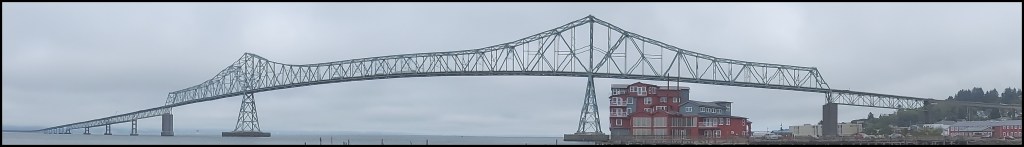
You have to cross the Columbia River to get into Astoria on the 4 mile long Astoria–Megler Bridge.
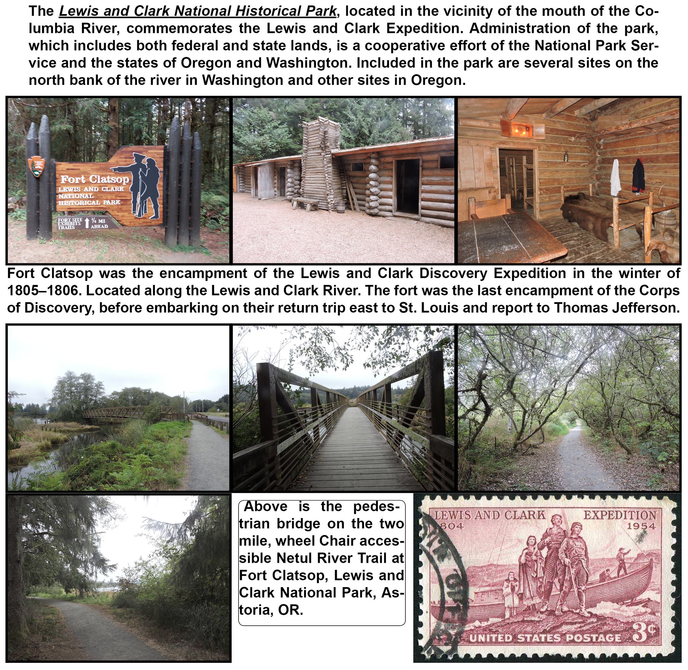
The top of my list in Astoria was to visit the Lewis and Clark National Historical Park and see the Peter Iredale ship wreck. I had several more stops on this wish list in Astoria but to keep on my schedule I will have to go back and visis Astoria at a later time to explore the:Astoria Column ◆ Bridgewater Bistro ◆ Fort Stevens State Park ◆ Georgia Boat maritime Memorial.
Click the above Covered Bridges Photo to view Uncle Jack’s next adventure at and around Cottage Grove, Oregon.
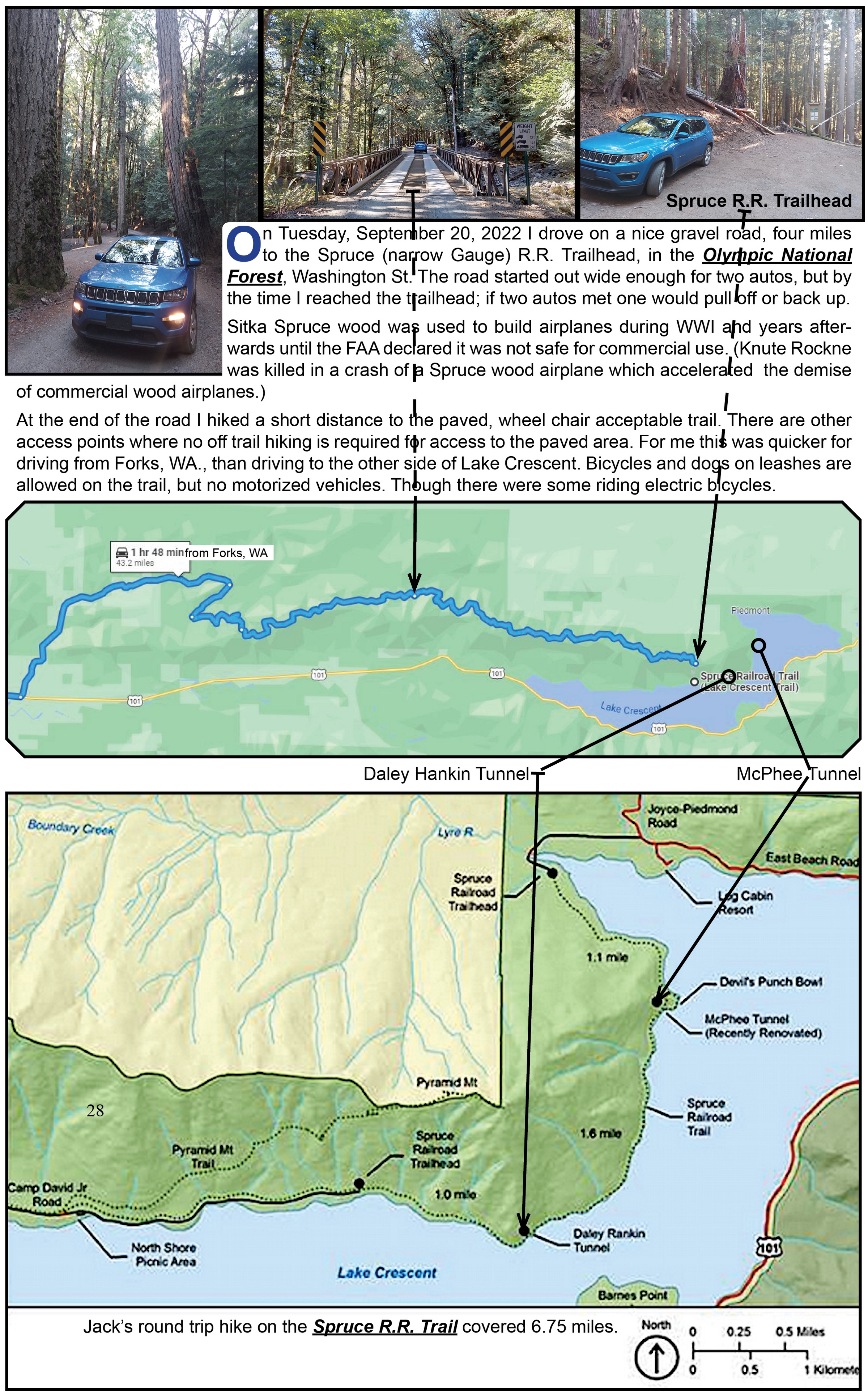
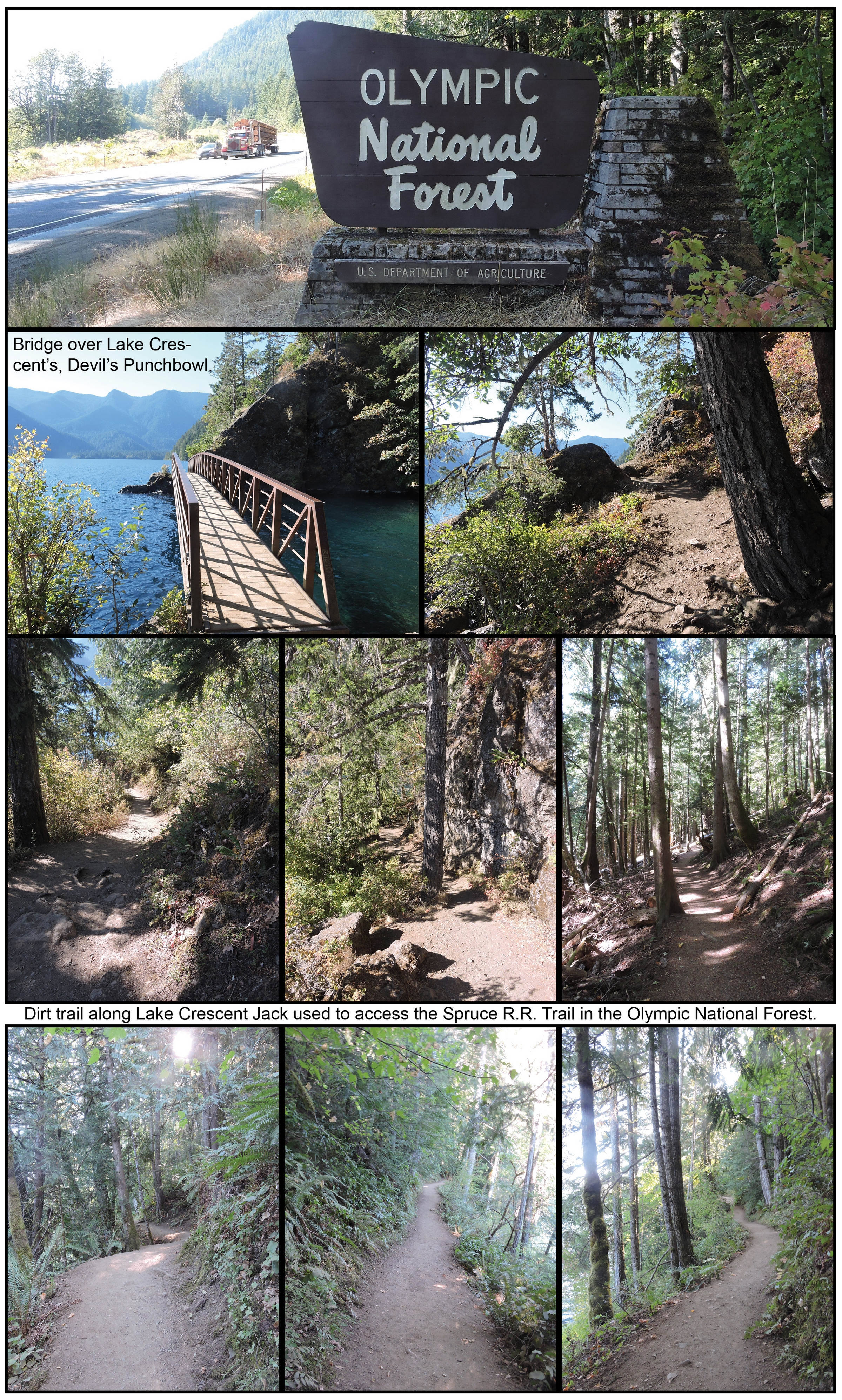
When I was looking for a route from Bellingham, WA to a drive along the Pacific Ocean, I looked at adventure options if I visited the Olympic National Forest. I found three hikes that were just the lengths I could handle with nice scenic views, that seemed appropriate. Good decision! Except!
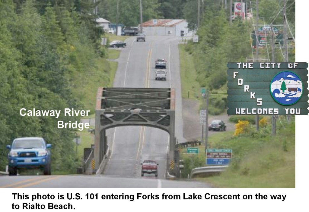
Except, I did not understand the route Google Maps showed on how I should drive to Forks, WA where I had motel reservations. It showed a line going over the Port Townsend Bay. I assumed this was a bridge. The car rental man tried to explain to me I should make a Ferry reservation. Still, not comprehending what I was going to encounter!
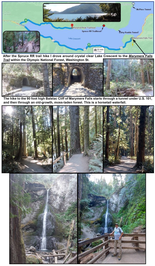
Well, after arriving at the Ferry Terminal without a reservation I figured it was quicker to go back and around Puget Sound to Forks. This meant I would drive by the Marymere Waterfall Trailhead after dark and arrive at the Forks Motel after it closed! The motel put my key under a mat and I did the Marymere Trail the next day.
Lesson learned; understand routes over water around Seattle, Washington!
Note; Logging Truck on road by the above Olympic National Forest sign. They are a common occurance on Washington’s roads. I initilly waited a minute to take another photo without a Logging Truck. Putting this blog together I included my original photo because forest products are Washington State’s third largest industry, employing over 100,000.
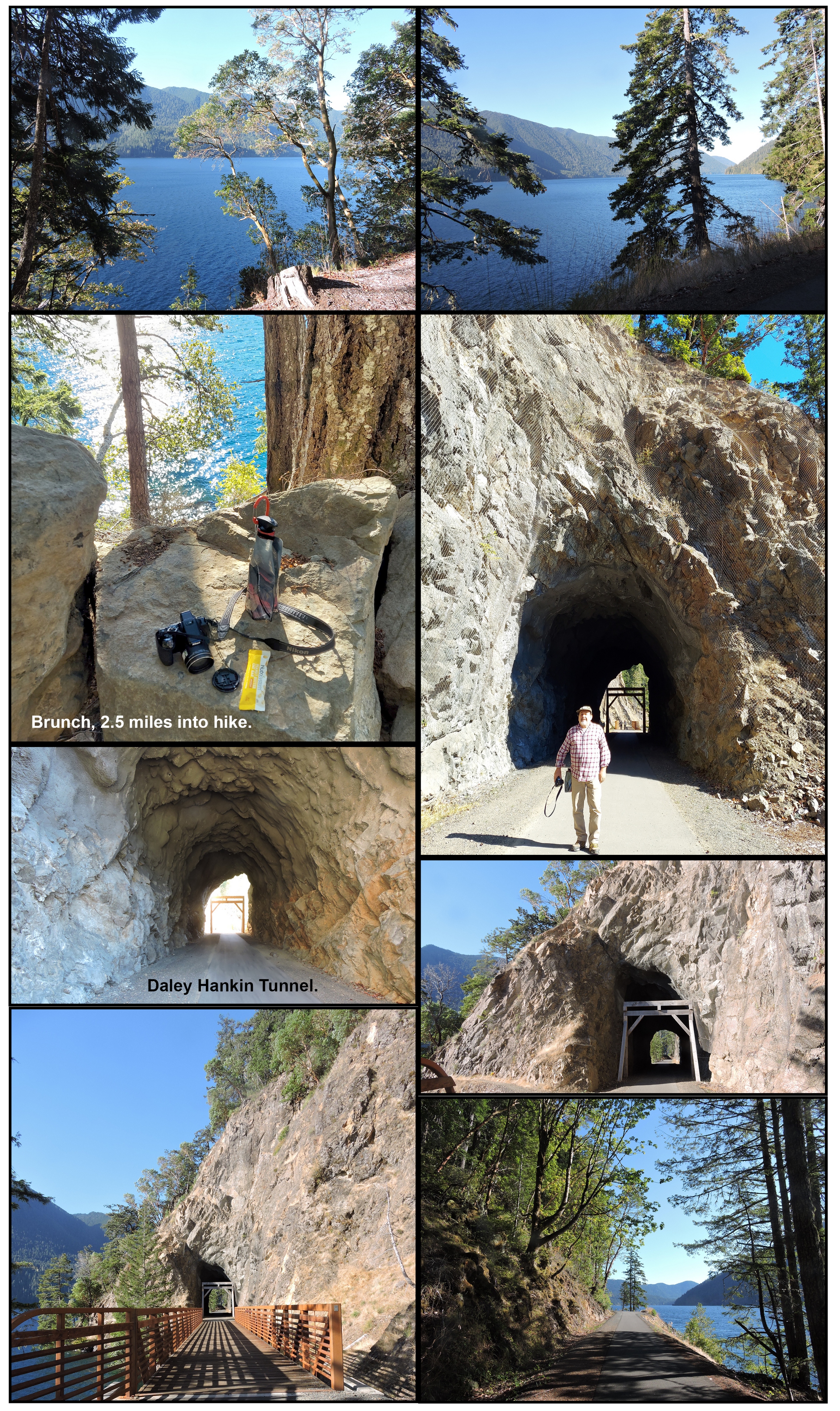
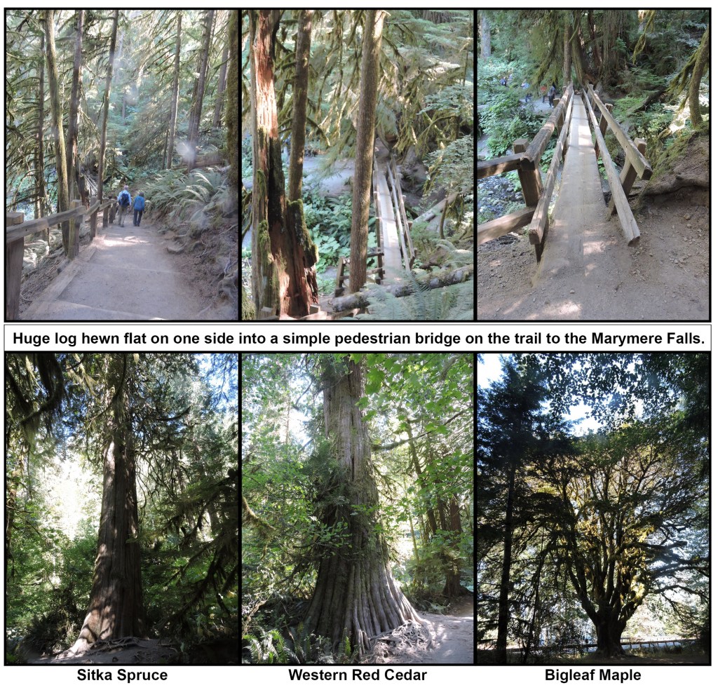
When I finished the Spruce R.R. hike I drove around Lake Crescent to the Olympic National Forest, Storm King Ranger Station, for a hike to the Marymere Waterfall.
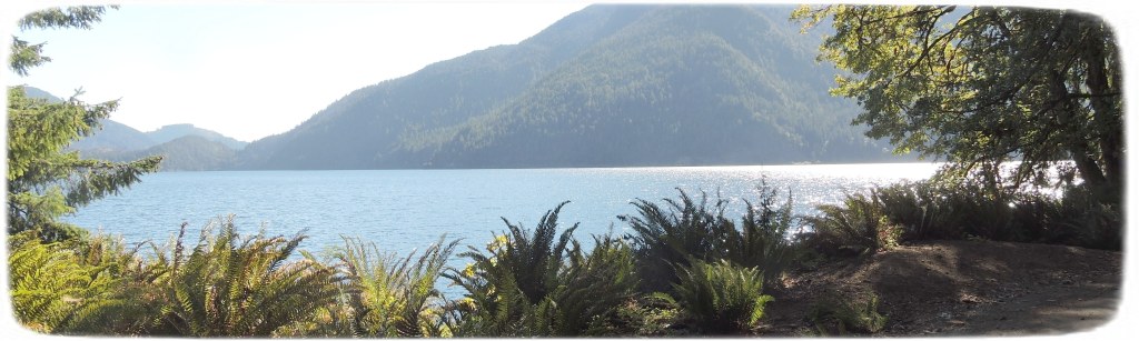
Lake Crescent, is a cold, clear, glacially-carved lake. Its azure depths, which plummet to 624 feet deep were gouged by the glaciers huge ice sheet thousands of years ago. As the ice retreated, it left behind this steep valley that filled with the clear blue waters.
The lake’s waters have very little nitrogen. This limits the growth of phytoplankton, tiny plants (like algae) that float in lake waters. Without them, the water stays clear. In some places you may see as far down as 60 feet. Clarity and reflecting light give Lake Crescent a stunning blue-green color.
Its protected waters are home to fish like the Beardslee and Crescenti trout, two types of fish found nowhere else in the world.
90 foot Marymere waterfall. Tallest waterfall in the Olympic National Forest.
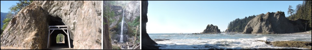
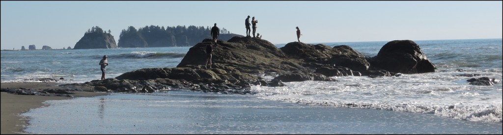
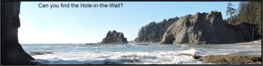
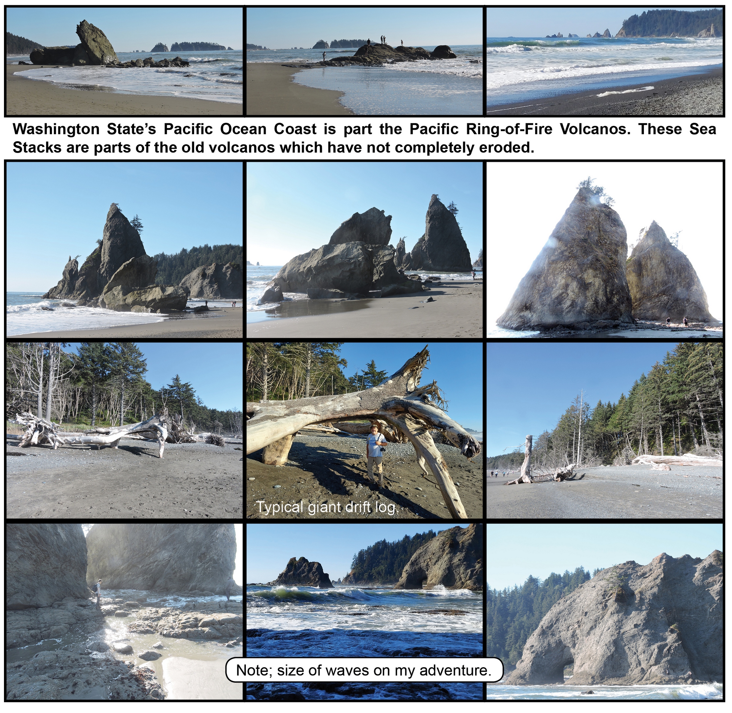
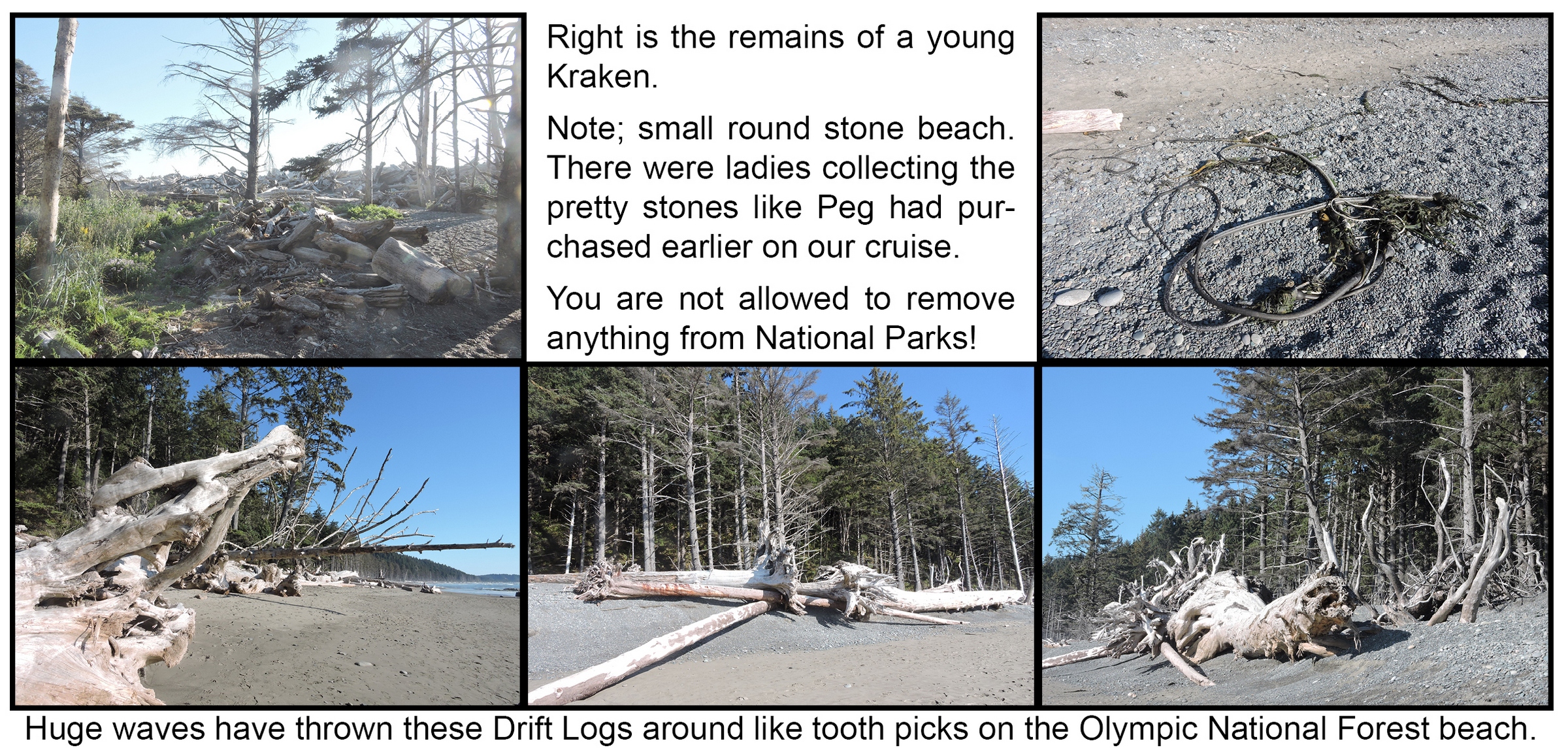
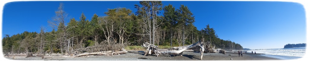
3-Mile, Rialto Beach hike to the Hole-in-the-Wall.
I hiked along a rocky beach, and giant drift logs, avoiding pounding waves with views of offshore islands known as “sea stacks.” These are the features that define the Rialto Beach.
Park Rangers tell hikers to be aware of large “Sneaker” waves that can wash you off protuding volcanic rock outcroppings. They also described what to do if you’re washed into a Rip Current.
Olympic National Forest Rangers also told me to only take this hike at low tide and, reminded me to never turn my back on the ocean. I had already checked the tied tables prior to arriving at the beach.
This was my third adventure hike of the day. It was early evening and I’d only eaten one energy bar on the Spruce R.R. Trail early in the morning. I figured their would be a nice seafood restaurant at a Pacific Ocean Coast beach, after 12 miles of hiking. Well! I was in the Olympic National Forest next to the Quileute Indian Reservation, NO restaurants near the Rialto Beach!
So I drove down the coast to the La Push fishing village, figuring where would there be no better place to have fresh sea food. Well! The only restaurant in town was closed. And, lots of police surrounding a nearby house with a young man in handcuffs being guarded by an armed officer. I got out of there quickly.
So I speedily drove back to Forks, WA, to the only nice looking restaurant in town, before they closed. The night before, I arrived in Forks 5 minutes before the 24-hour gas station closed and I only got a can of coke and a bag of chips for dinner!
FYI – Forks (Forks is also the rainiest town in the contiguous United States), Washington is the town the Twilight Saga is based in. I only explored the Rain Forest and Beach of the Olympic National Forest just like Bella, hoping for maybe a glimpse of a vampire or werewolf! I am not a Twilight groupie, and did not follow a Twilight tour program. I did not go to Sully’s Burgers drive-in for a “Bella Burger,” with plastic fangs. For the ultimate Twilight fan there is a Forever Twilight Festival in Forks annually. This event is held the weekend closest to Bella’s Birthday (September 13th).
Click the above Bridge Photo to view Uncle Jack’s next adventure at, Fort Stevens State Park, and, Lewis and Clark National Historical Park, in Astoria, Oregon.
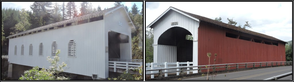
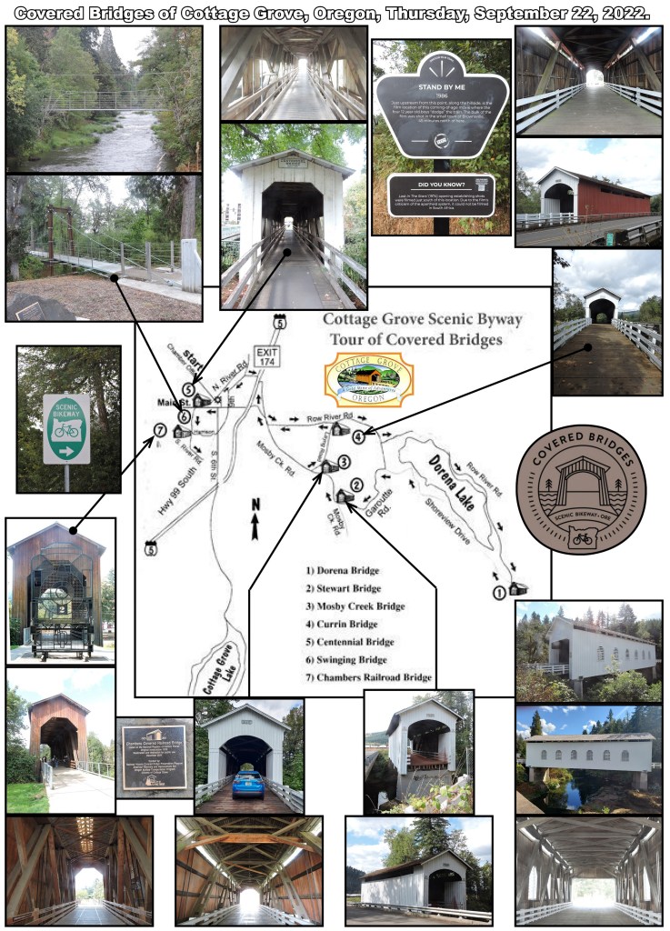
In planning my September, 2022 adventure I found information on the beautiful 1880 bridges in Cottage Grove, Oregon. They are listed on the National Historic Register around this charming town of Cottage Grove over rivers and creeks. This is the home of the largest collection of Covered Bridges in the West, and known as the “Covered Bridge Capital of the West.”
When I got to Cottage Grove I started following the signs of the 20 mile rambling route around the towns biggest attractions; six Covered Bridges and one Swinging Bridge. If I’d named the new modern built “Swinging Bridge,” I’d have named it the “ Bouncy Bridge!” It was a fun bouncy walk across. I was told the original Swinging Bridge (which actually swung when walked upon) was destroyed in a flood.
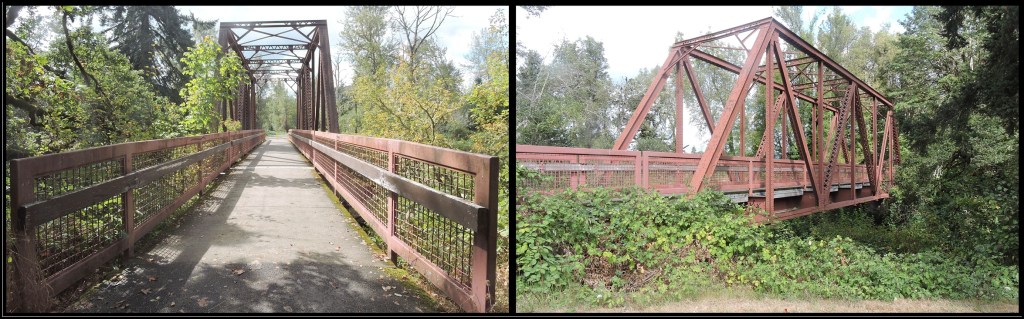
The 78 foot long Chambers Railroad Covered Bridge, #7, is a four-leaf-truss structure is the largest Railroad Covered Bridge West of the Mississippi.
For me signs were difficult for me to follow because of the distance between them. I used Google Maps to locate the Covered Bridges outside of the city of Cottage Grove without any problems.
The tour route is actually designed as a Covered Bridge Scenic Bikeway, which can also be hiked.
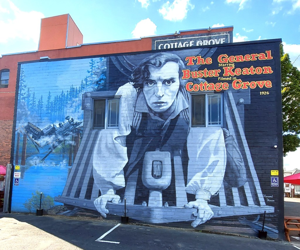
The coming-of-age movie, Stand By Me was filmed in the summer of 1985 in Oregon, with the railroad scenes in Cottage Grove. This is the bridge that the boys crossed at the beginning of their adventure. It is an extremely short walk from the Mosby Creek Bridge to this iconic railroad bridge. The railroad track that went over this bridge is now the Row River (bike and hike) Trail.
Cottage Grove, Oregon is more than just Covered Bridges. It is one of my favorite towns I visited in 2022 and it has very nice sidewalk cafes I can vouch for.
You can easily spend a day or two relaxing in this little town.
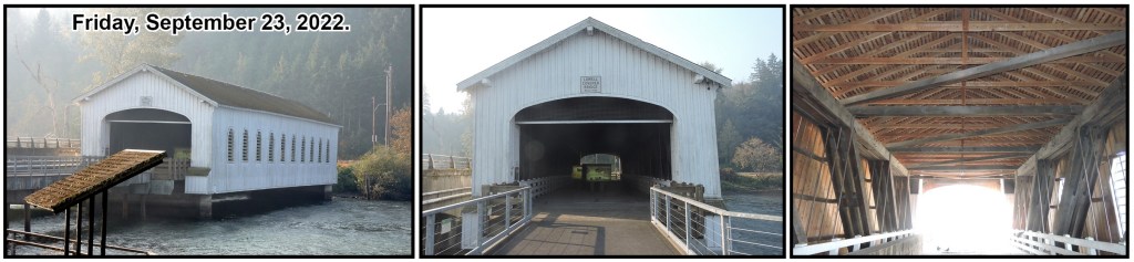
The Lowell Covered Bridge, above is 165 foot long, over the Willamette River near Lowell, Oregon. I was driving from Cottage Grove to the Crater Lake National Park, Friday, September 23, 2022 on OR-58 and stopped to photograph this covered bridge. There are still 54 Covered Bridges in Oregon. I did not want to spend the time on this trip to photograph all of them!
In 1925, Oregon had over 450 Covered Bridges. In 1915 virtually all new bridges were covered timber truss bridges. By 1925 consciences; longevity was considered to be at least 50 years for Douglas Fir Timber Covered Bridges in Oregon.
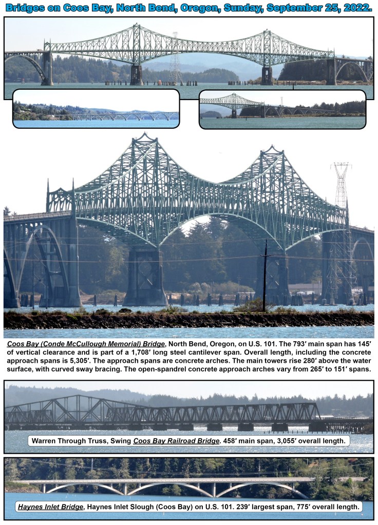
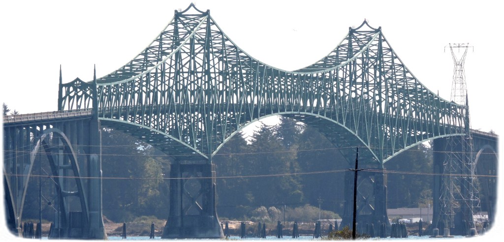
Click on the photo of the Coos Bay (Conde McCullough Memorial) Bridge to view dozens of other bridges from my drive down the coast of the Pacific Ocean from Vancouver, B.C. to San Francisco.
Click the below Photo to view Uncle Jack’s next adventure Crater Lake, Oregon.
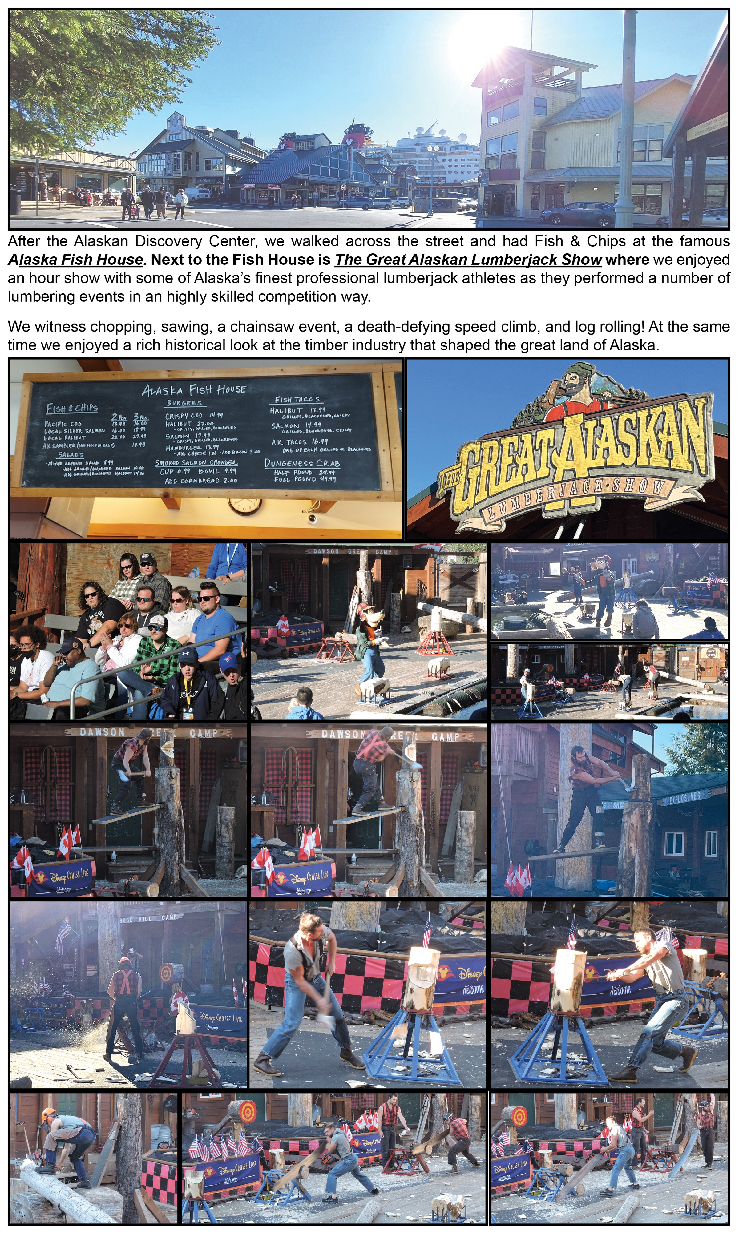
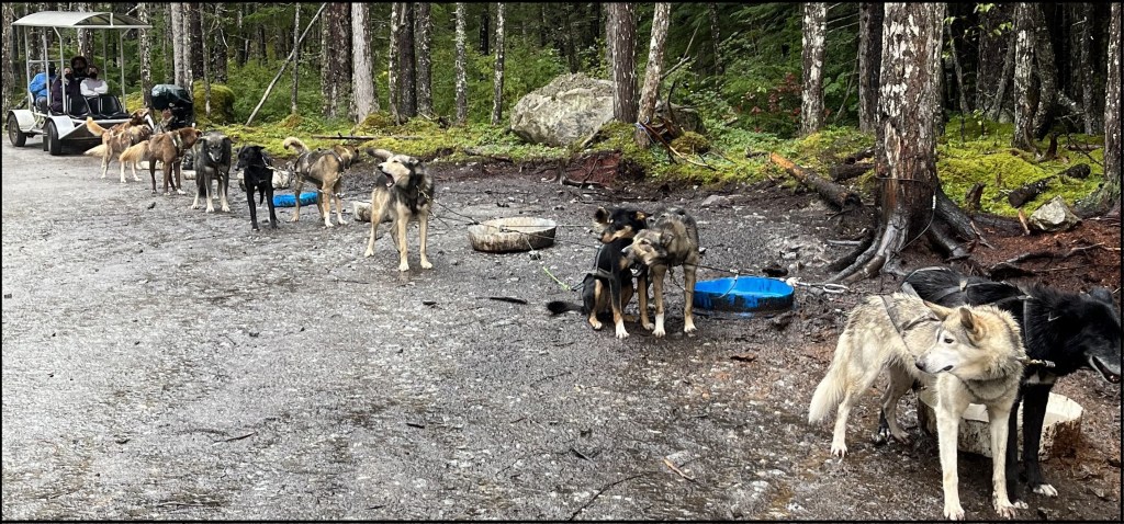
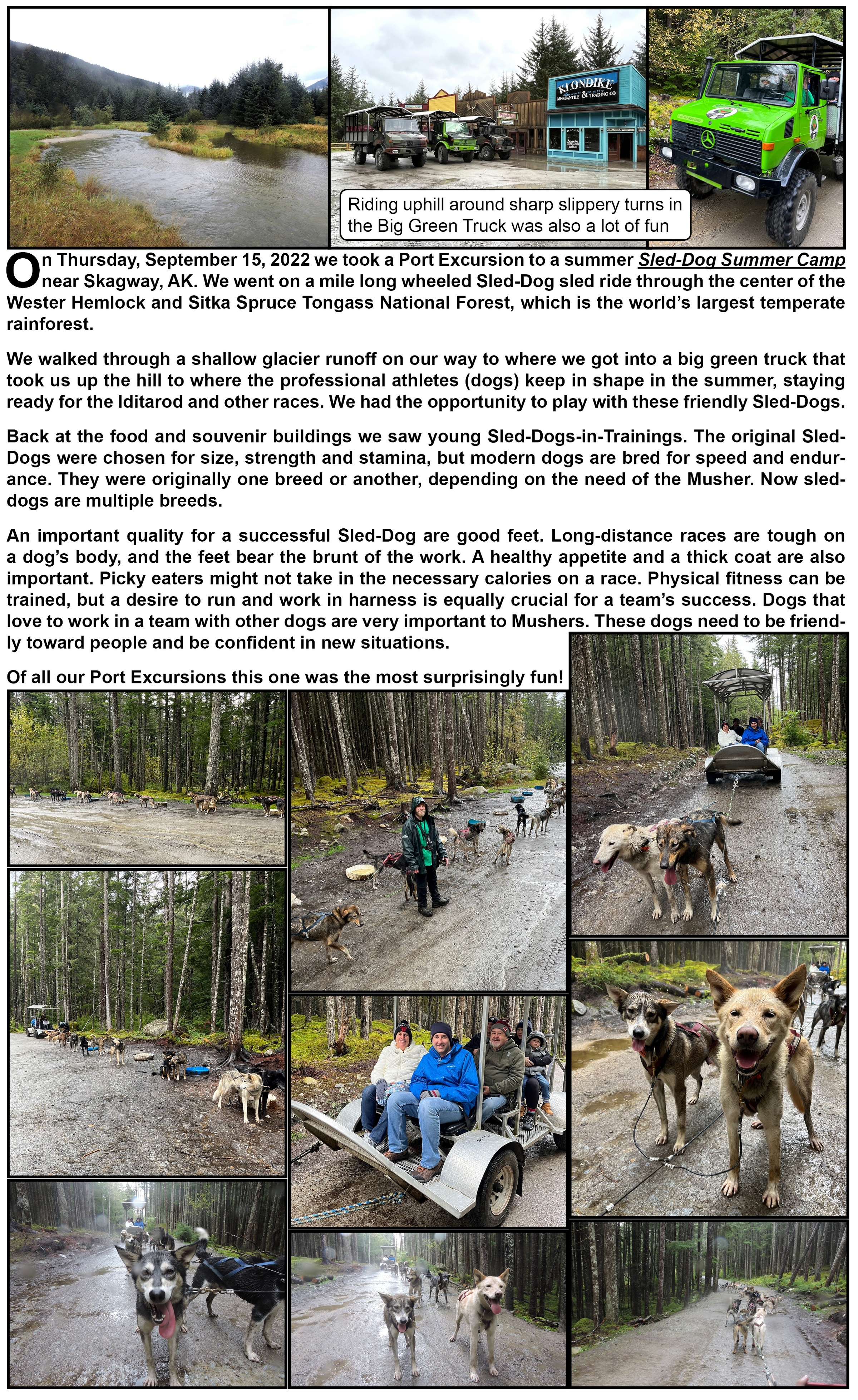
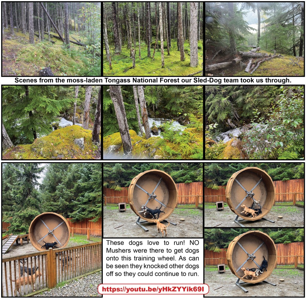
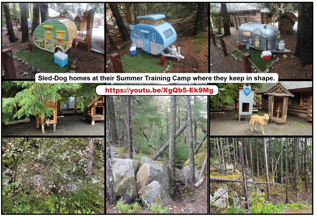
Exciting Sled-Dog ride towed by ecstatic professional Sled-Dog athletes.
On Thursday, September 15, 2022 we immersed ourself in the wondrous world of dog mushing from a cruise excursion.
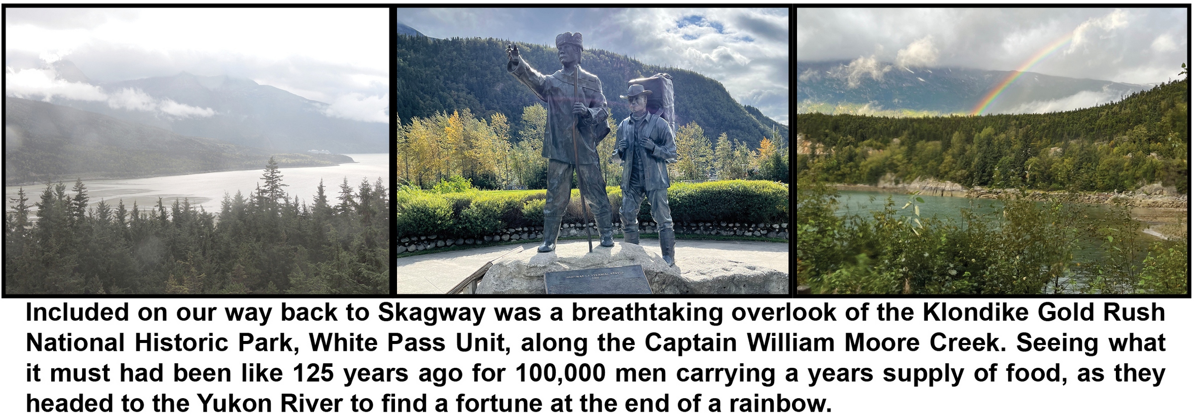
After the bus ride to the Sled-Dog Summer Camp, we boarded our 4×4 German military vehicle for a wild ride up the mountain where we were greeted by Mushers and several ecstatic Sled-Dogs! We enjoyed a summer sled ride on custom-built sled, where we were towed by “professional Sled-Dog athletes” through the Tongass National Forest on a rugged zig-zagging mountain road. After history about dog mushing we soaked up some puppy love before entering the gift shop and returning to Skagway by way of a breathtaking valley overlook of the old route taken by prospectors during the Klondike gold rush.
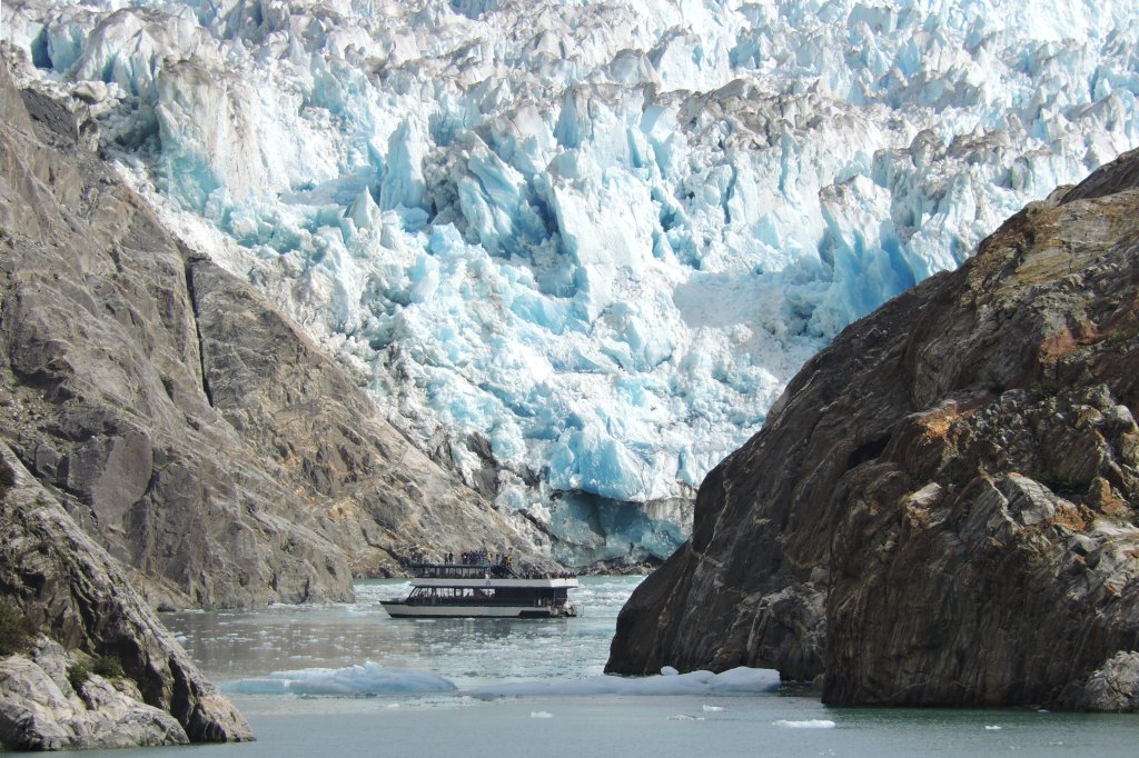
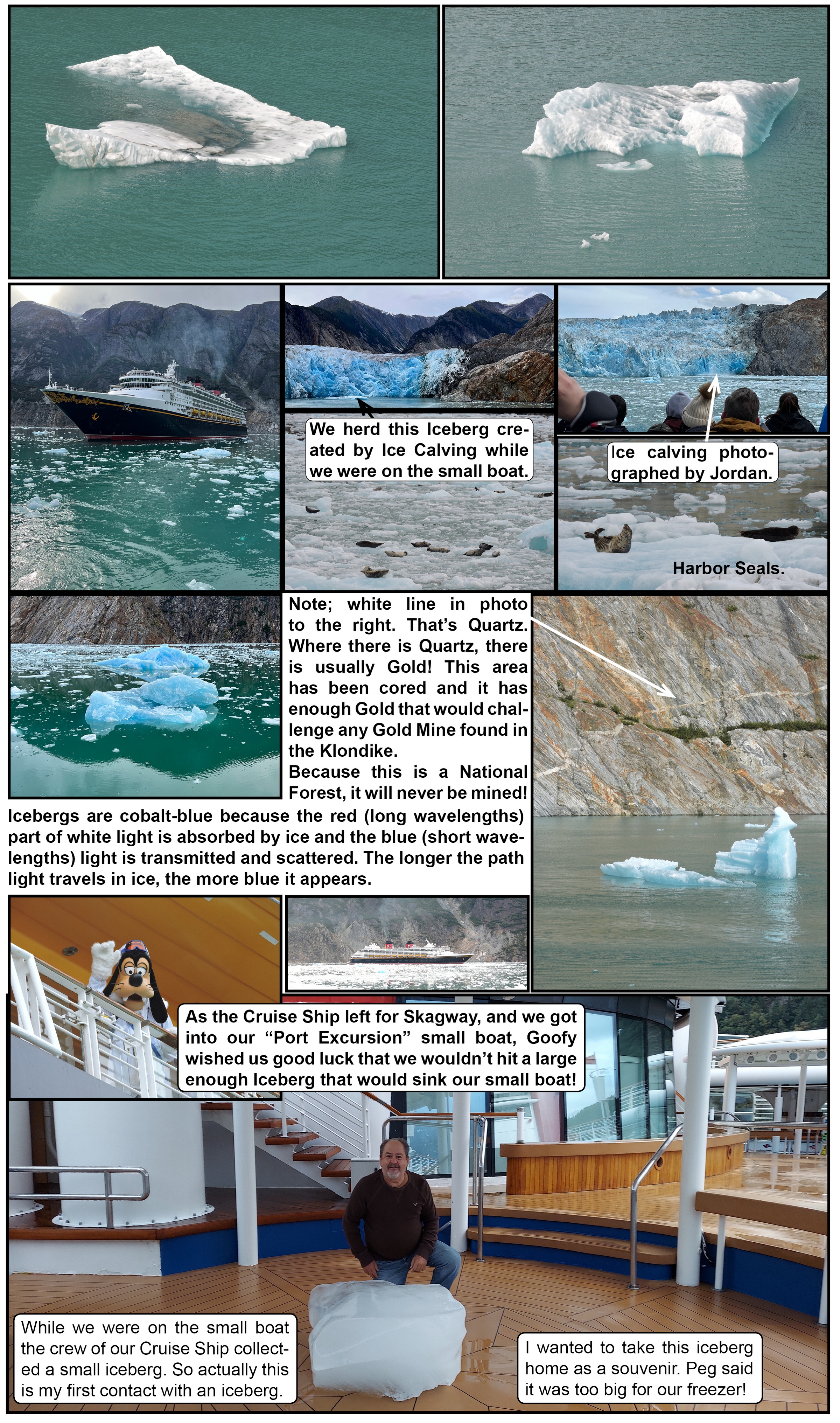
The Dawes Glacier retreated 2.4 miles from 1985 to 2020!
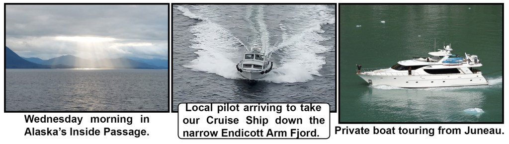
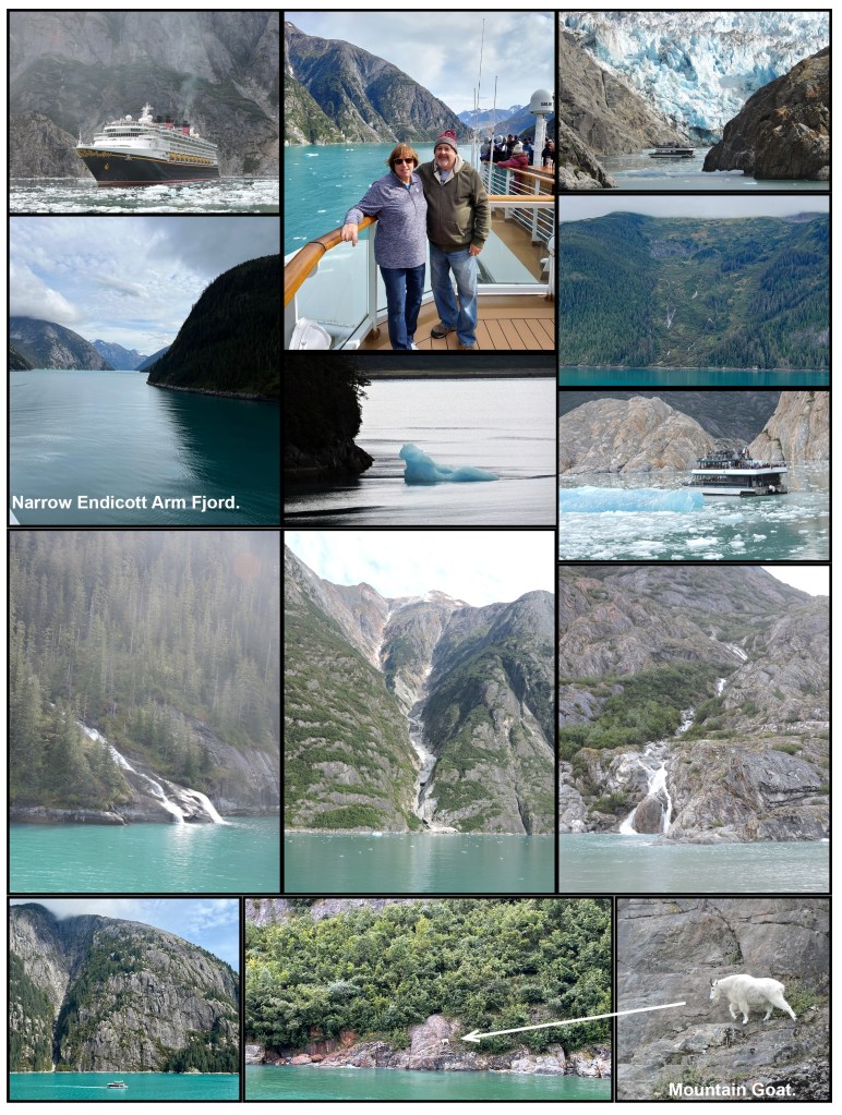
On Wednesday, September 14, 2022 we cruised into the 30-mile long Endicott Arm Fjord within the Tongass National Forest. This Fjord has soaring cliffs, cascading waterfalls, and we had two wild animal sightings. Our Cruise Ship got us as close as it could to the Dawes Glacier, until the icebergs got too big and numerous! We had picked up a local Cruise Ship Pilot earlier in the day to navigate our ship down this narrow Fjord.
The tidewater Dawes Glacier is over 600 feet tall and around one mile wide.
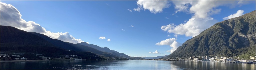
The Fjord is located about 60 miles southeast of Juneau, AK within the Inside Passage. This tidewater glacier carved this Forjd over the thousands of years.
Technically, most of the small hunks of ice we encountered are classified as “Growlers” and “Berg Bits,” not Icebergs. They’re too small to be classified as Icebergs. I use the term Icebergs, because I like the name!
For our “Port Excursion” in the Fjord we took a small (78-foot, 140-person) catamaran boat, to get us much closer to the Dawes Glacier. Two catamarans come down from Juneau for the day our Cruise Ship was in the Fjord. For those that did not take the “Port Excursion,” our ship did a full turn in the Fjord, allowing all guests on all sides of our Cruise Ship the opportunity to see the glacier.
Today Its icebergs provide breeding and whelping grounds Harbor Seals. We witness two ice calving, which is when heavyweight chunks of ice fall off and shed into the seawater, creating icebergs.
Due to strict environmental restrictions, cruise ships visiting the area have specific times of the day that they’re allowed to venture through the Endicott Arm Fjord. Our Cruise Ship had a naturalist narrating the voyage through the Fjord, pointing out factoids about the Fjord. However, due to strict sound pollution rules, there were portions of the journey when the naturalist had to stop speaking through the ships P.A. system.
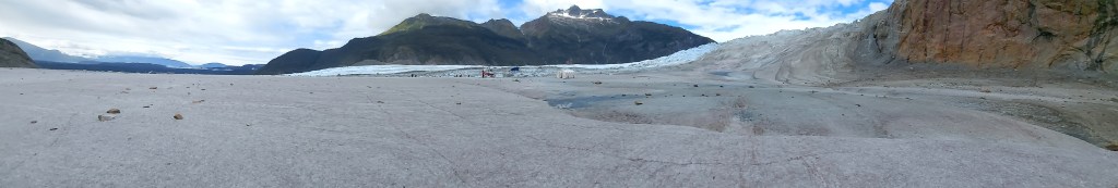
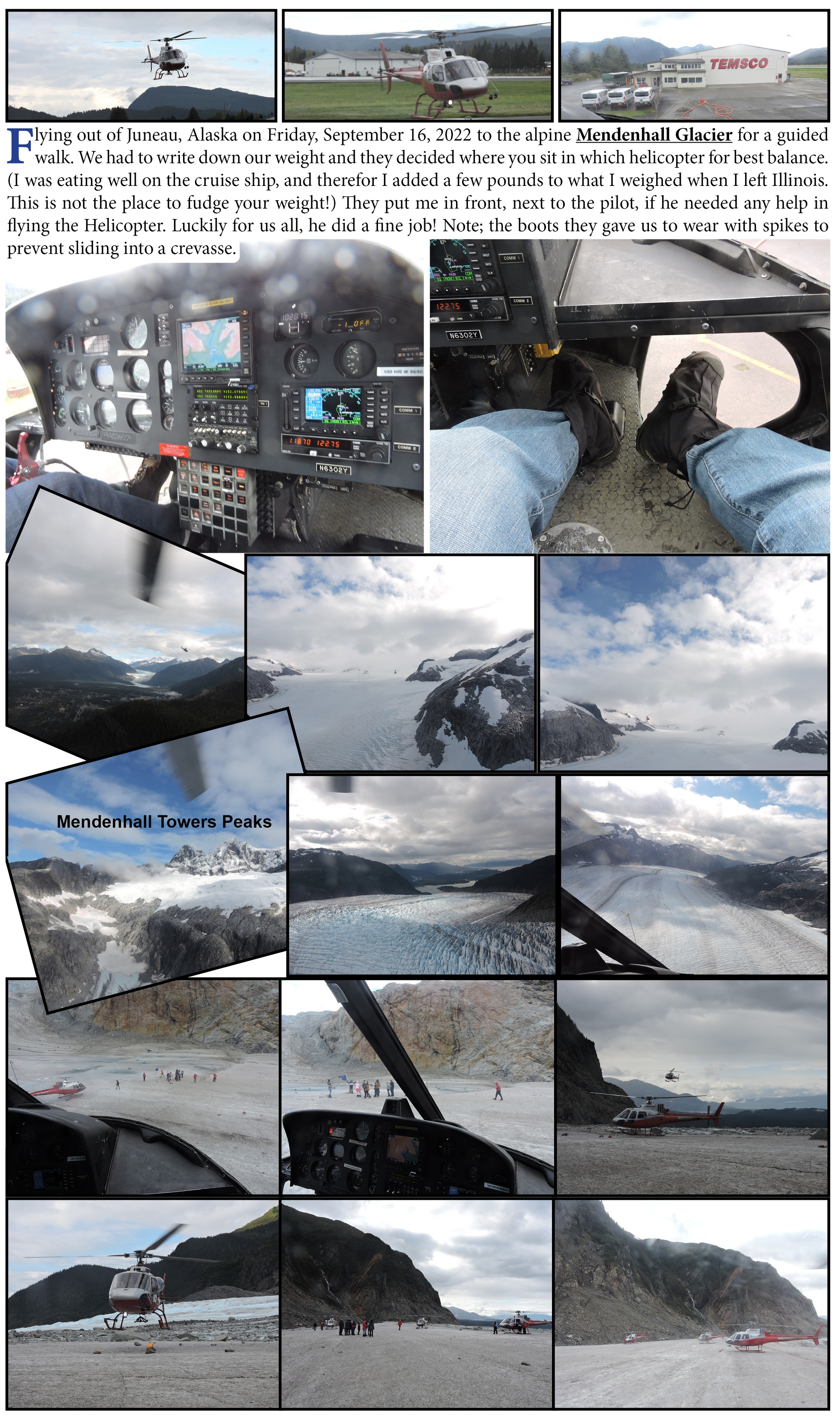
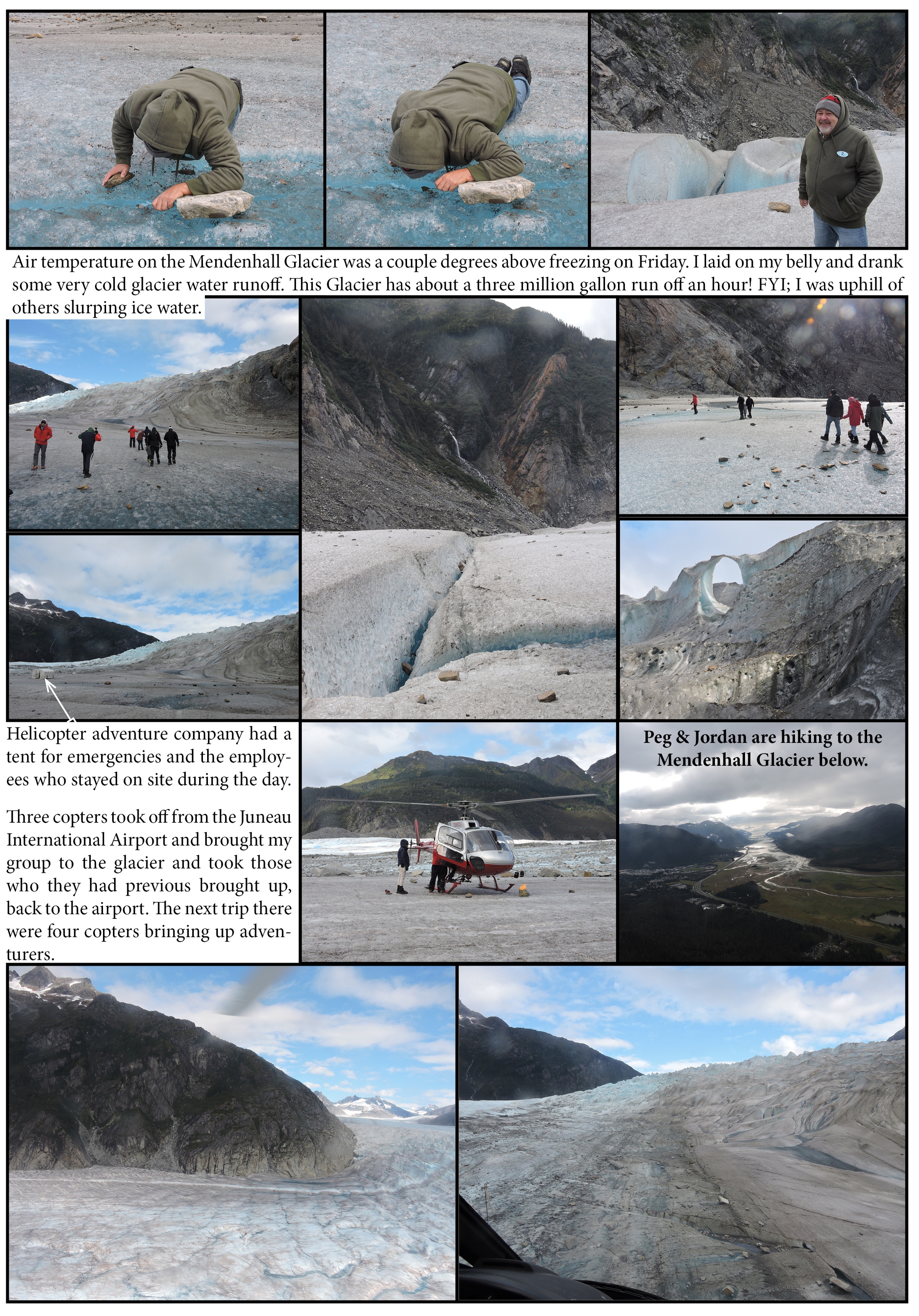
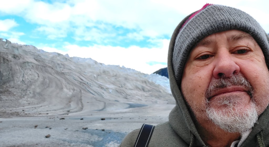
The Mendenhall Glacier shrunk nearly 1,800 feet from melting between 2007 and 2015.
Three copters took off from the Juneau, Alaska International Airport and brought my group from the cruise ship to the glacier and took those who they had previous brought up, back to the airport. The next trip there were four copters bringing up adventurers.
The helecopter ride was not scary! It was very smooth and the only sensation on a turn, was looking down at the glacier.
I walked on Fire (cooled lava in Hawaii) and this adventure has resulted in me walking on Ice (ice skating doesn’t count).
I have now walked on Fire and Ice!
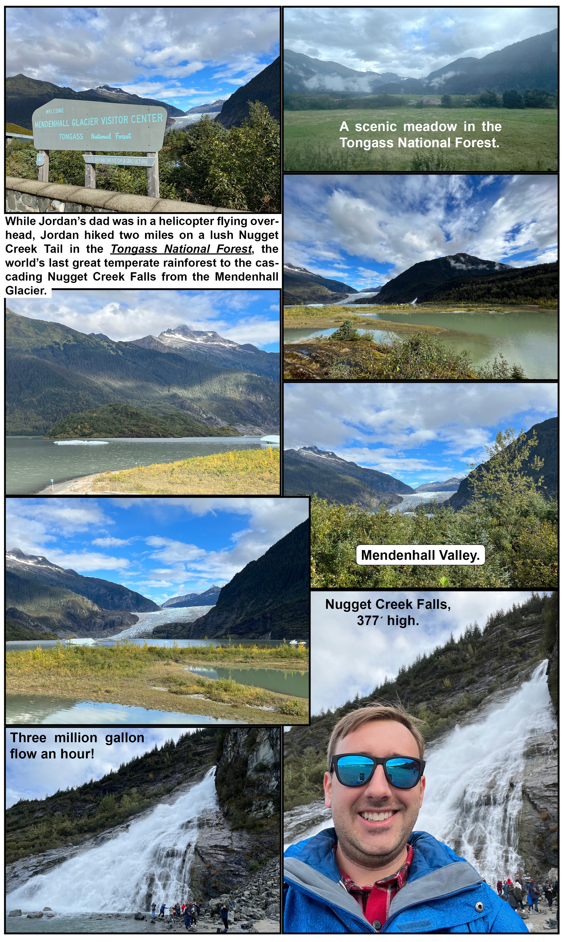
While I was in a helicopter flying overhead, Jordan hiked two miles on a lush tail through the Tongass National Forest, (the world’s last great temperate rainforest) to the cascading Nugget Creek Falls from the Mendenhall Glacier.
Below is one of several minor streams that Jordan crossed on the Nugget Creek Trail.