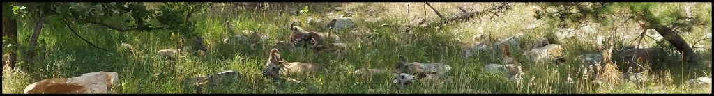
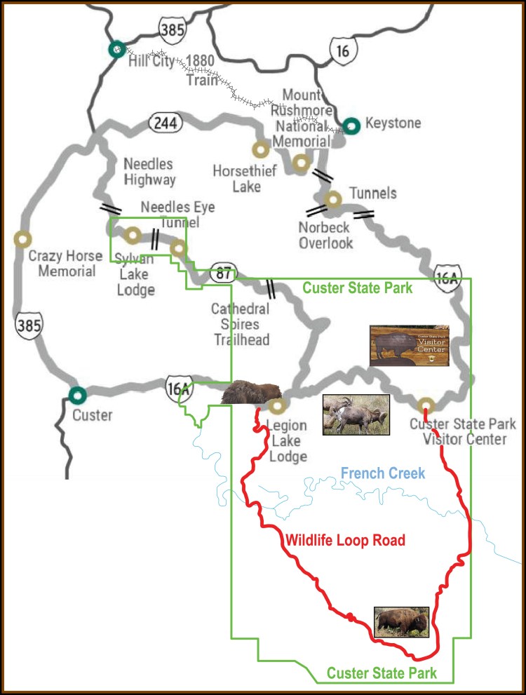
I took the Wildlife Loop Road into the Black Hills National Forest and photographed the Bighorn Sheep. Expected travel time on the Wildlife Loop Road is about 1.5 hours — travel time is dependent on “wildlife jams.” The Wildlife Loop Road twists and turns its way through the prairie and ponderosa pine-studded hills that harbor many of the park’s wildlife species. This picturesque drive; and changing landscape keeps you on your toes looking for good photo opportunities.
Lieutenant Colonel, George A. Custer led an expedition that he claimed discovered gold along French Creek in 1874.
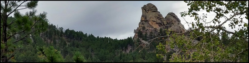
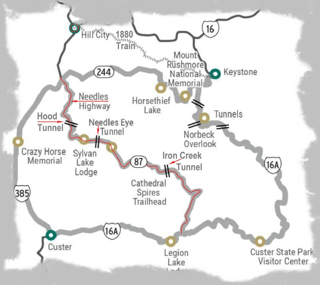
The Iron Mountain Road, in South Dakota, has been described as an incredible journey, an unforgettable 17 mile experiences. The road was designed as a work of art to make you slow down, to see and feel things that you don’t experience every day. It was specifically designed with a tremendous amount of curves, including what is referred to as switchbacks, in order to limit the speed of travelers to less than 35 miles per hour so you can enjoy the beauty of the Black Hills National Forest. Notable is the fact that the Iron Mountain Road (US-16A) was purposely built directly over its summit of the Iron Mountain to provide scenic views of the Mount Rushmore National Memorial.
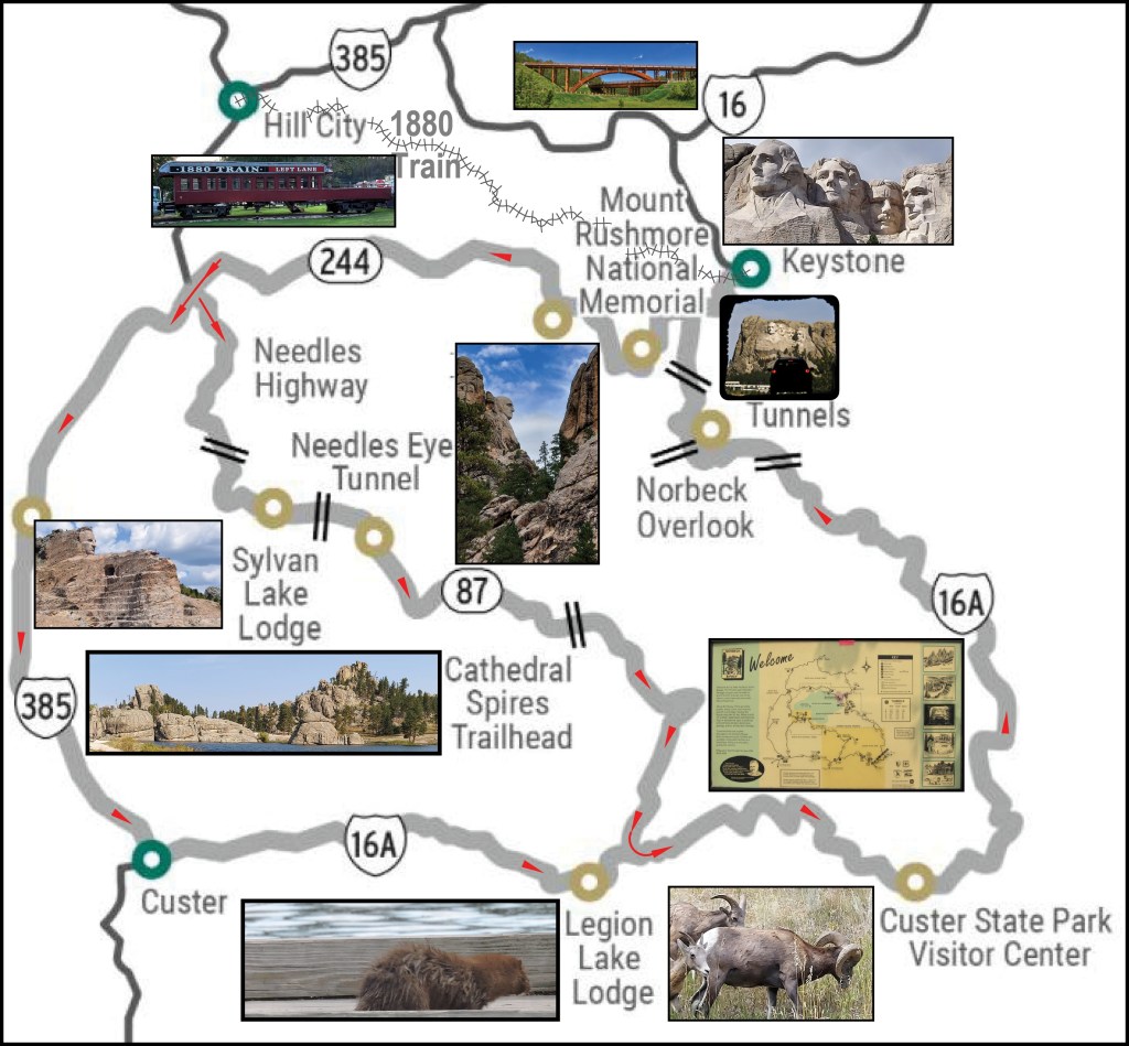
These features of this road include wooden structures, called pigtail bridges, and one lane tunnels that were built to showcase the American patriotic symbol, Mount Rushmore. These tunnels frame the Mount Rushmore National Memorial like a picture frame and are spectacular sites to photograph – depending on which direction you are traveling, you may have to look in your rear view mirror to experience this wonder. It is recommended you travel this road in both directions – you will see and experience different things each way. If you only have time for traveling one direction, make that direction North!
The byway enters Custer State Park along its south-eastern edge and turns west at its intersection with Iron Mountain Road toward Mount Rushmore and away from Custer State Park. The Iron Mountain Road portion of the highway includes three tunnels and pigtail bridges is within the Iron Mountain Road. You should take this portion going North because of the tunnels that were carved for construction of the road align with a view of Mount Rushmore when you are driving North.
I entered the byway from Hill City as shown below. I missed much of the Iron Mountain Section, because I hadn’t reviewed the route and went to Rapid City trying to get my Nikon camera to function! Cell Phone camera works fine, but, my old Nikon has controls the Cell Phone does not offer.
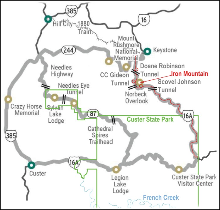
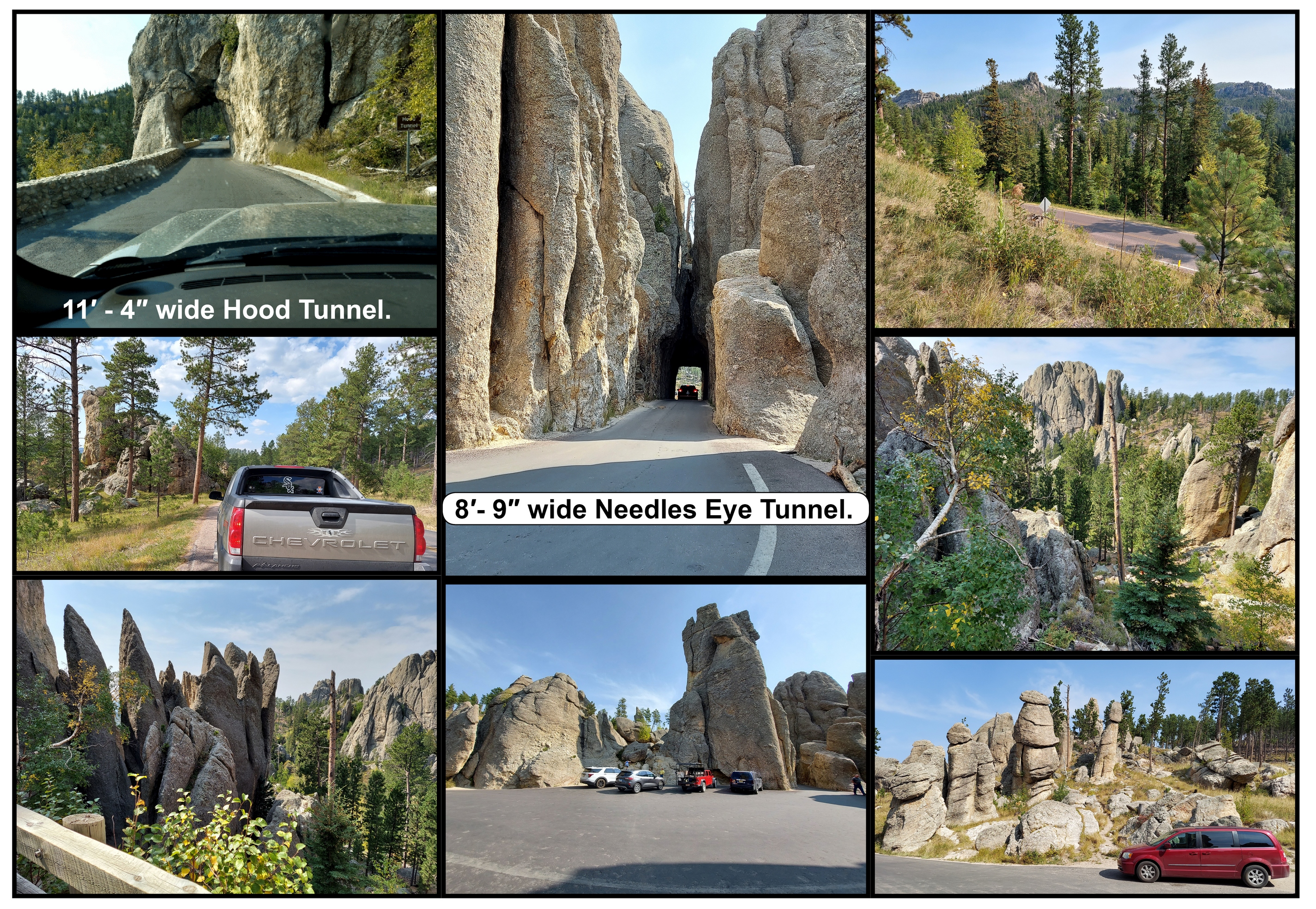
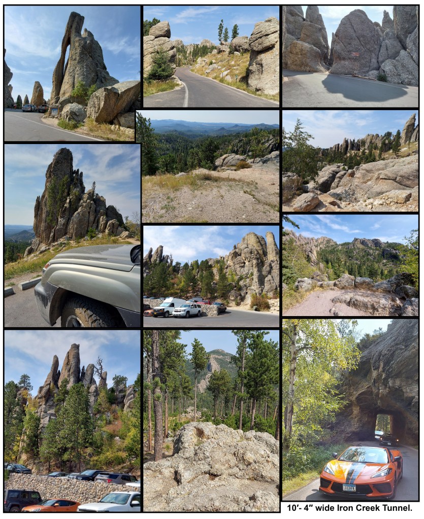
The Needles Highway is more than a 14-mile road — it’s a spectacular drive through pine and spruce forests, plus meadows surrounded by birch and aspen, with rugged granite mountains, once thought of as the material to sculpture many of the US Presidents. The road’s name comes from the needlelike granite formations that seem to pierce the horizon along the highway, created by wind, rain, freezing, and thawing.
I traveled this 14 mile Needles Highway North to South from Hill City, SD stopping and hiking around Sylvan Lake, Center Lake and Stockade Lake, and slowing down at the single lane tunnels.
Note how the pillars, towers, and spires, known as Needles were thought to be candidates for sculptures.Needles Highway.
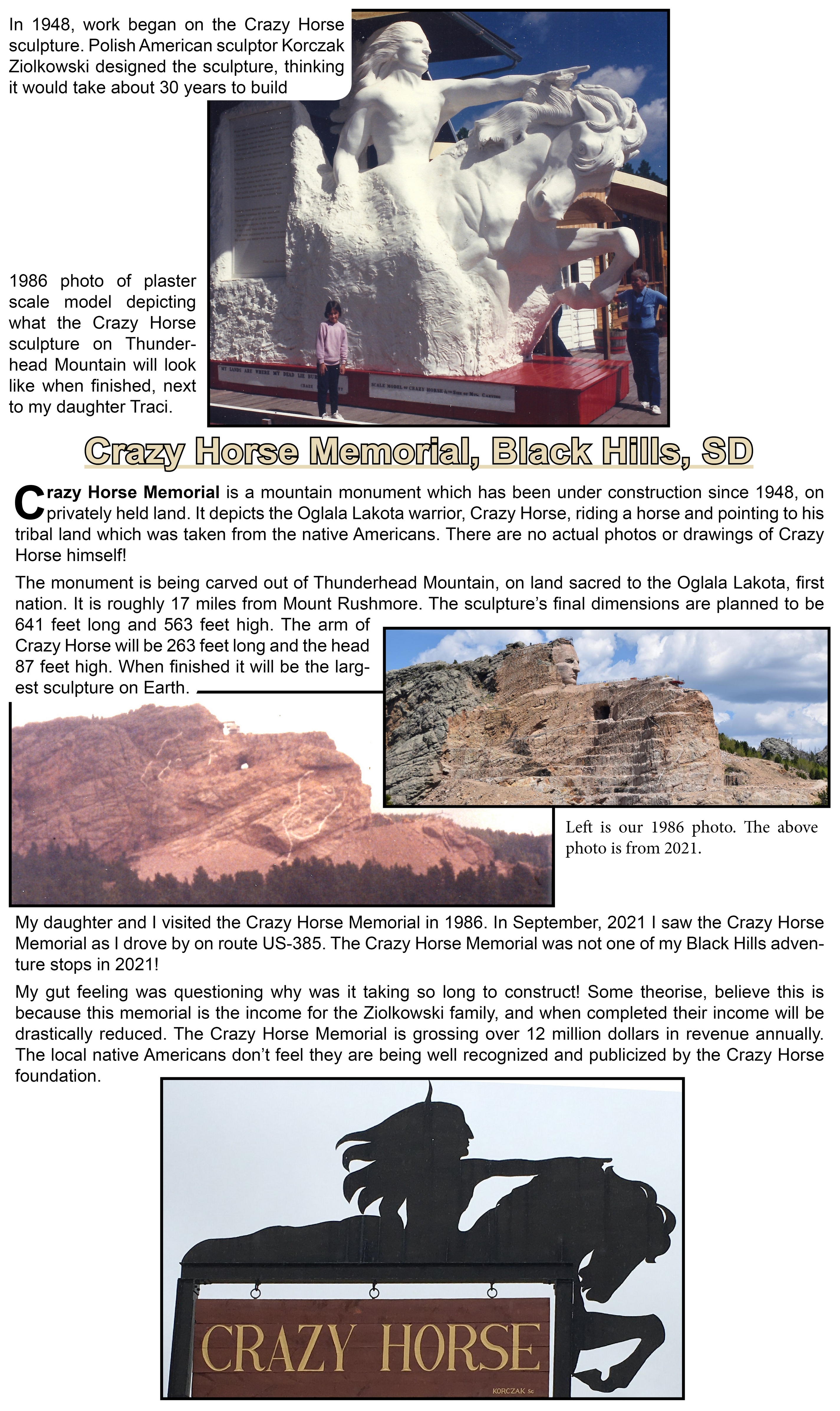
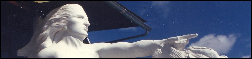
Emerging from granite in the Southern Black Hills is the Crazy Horse Memorial — in the process of being the largest Mountain Carving.
The dream began in 1939 when Chief Henry Standing Bear invited sculptor Korczak Ziolkowski to create a tribute to the North American Indians to show that “the red man has great heroes, also.”
Admissions and contributions finance the memorial, and they do not accept federal or state funding. The organization is very protective of their intellectual rights!
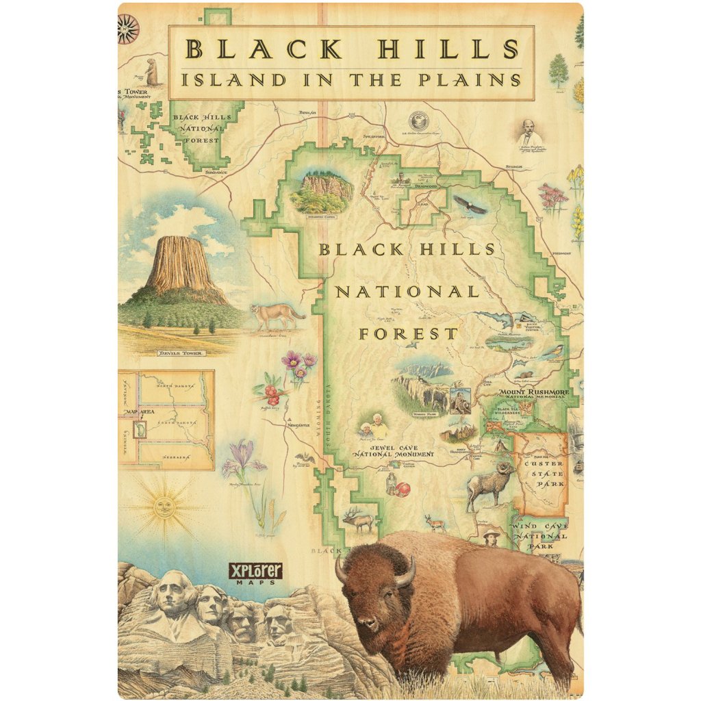
Black Hills, in western South Dakota and northeastern Wyoming, consisting of 1.2 million acres of forested hills and mountains.
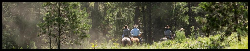
The Black Hills rise from the adjacent grasslands into a Ponderosa Pine forest. This area has been described as an “Island in the Plains,” the Forest has diverse wildlife and plants reaching from the eastern forests to the western plains. This is a multiple-use Forest with activities ranging from timber production, grazing, hiking, camping, mountain biking, horseback riding, rock climbing, mining, wildlife viewing and many more adventures.
I pleasantly enjoyed climbing and viewing the many rugged rock formations, canyons and gulches, open grassland parks, streams, and clear lakes with sandy beaches.
The Black Hills have since prehistoric times had a mystique about them that has drawn man to the area for eons. The Indian Tribes considered the Black Hills Sacred Ground and very few ever entered the area of the higher hills. One reason was that they heard loud booming noises and thought that the Black Hills was the home of many spirits that they believed in. The consensus now is this was from thunder storms that made these noises.
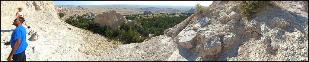
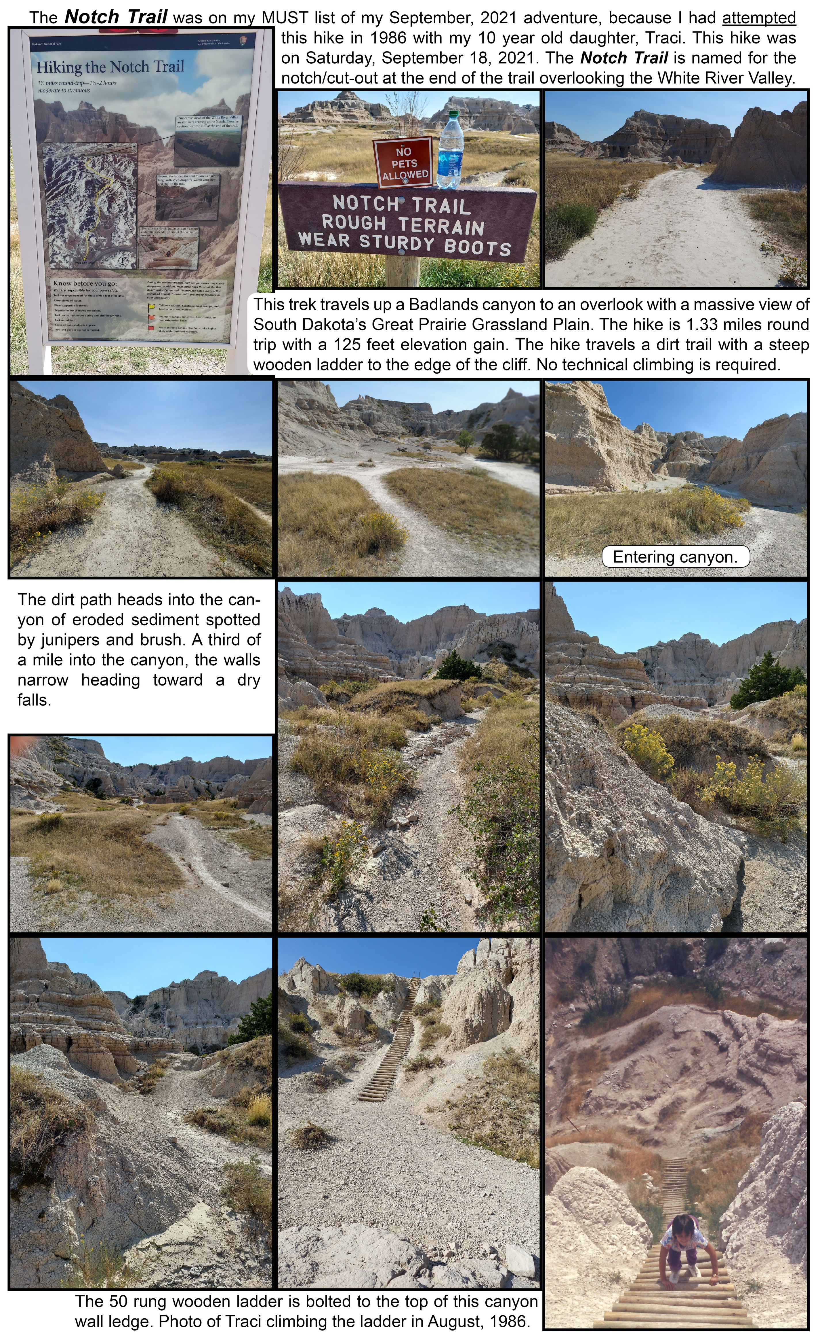
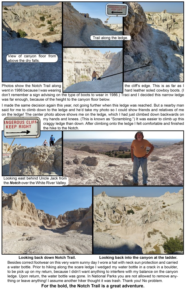
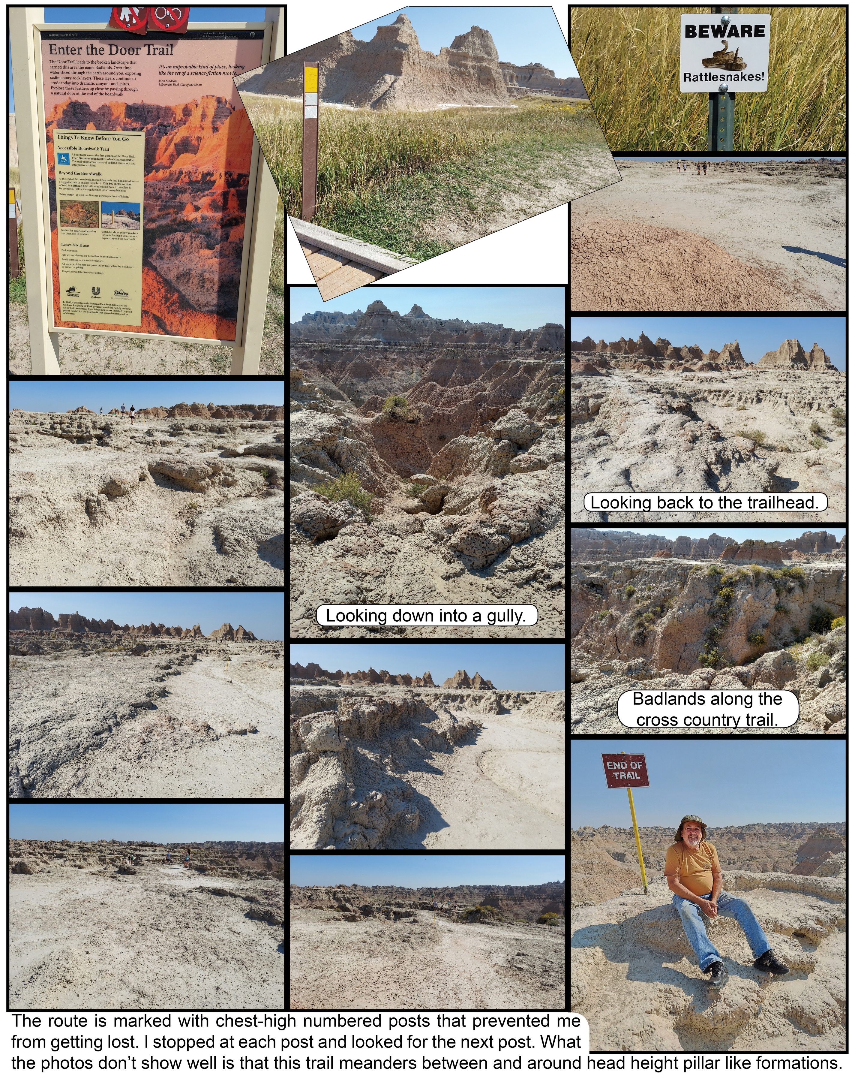
This trek travels up a canyon within the Badlands National Park to an overlook with a great view of South Dakota’s Great Prairie Grasslands Plain. The hike is 1.3 miles round trip with 125 feet of elevation gain. This hike does not have a boardwalk to follow, just a dirt trail and a steep wooden ladder. Notch Trail also traces a cliff’s edge so it is not a good option for hikers with a fear of heights. For those interested in a little adventure, this hike has a lot to offer.
For those interested in a little adventure, this hike has a lot to offer.
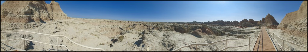
The Door Trail is an opening in a Cliff Shelf Wall at the Badlands National Park, that introduces hikers to a rugged world. While nearby Window Trail allows visitors to look over the wall, the Door Trail lets you walk through it. A short boardwalk made of recycled planks (disabled accessable) takes hikers through a natural passageway to a viewing platform. Beyond that, I followed a relatively flat path across the formidable landscape to overlooks with views into the deep and steep eroded canyons. You will feel completely immersed in the badlands on this 1-mile round trip hike with only a 50 feet of elevation gain.
The Door Trail leads to the broken landscape that earned this area the name Badlands.
This is a relatively easy trail for a person new to the activity.
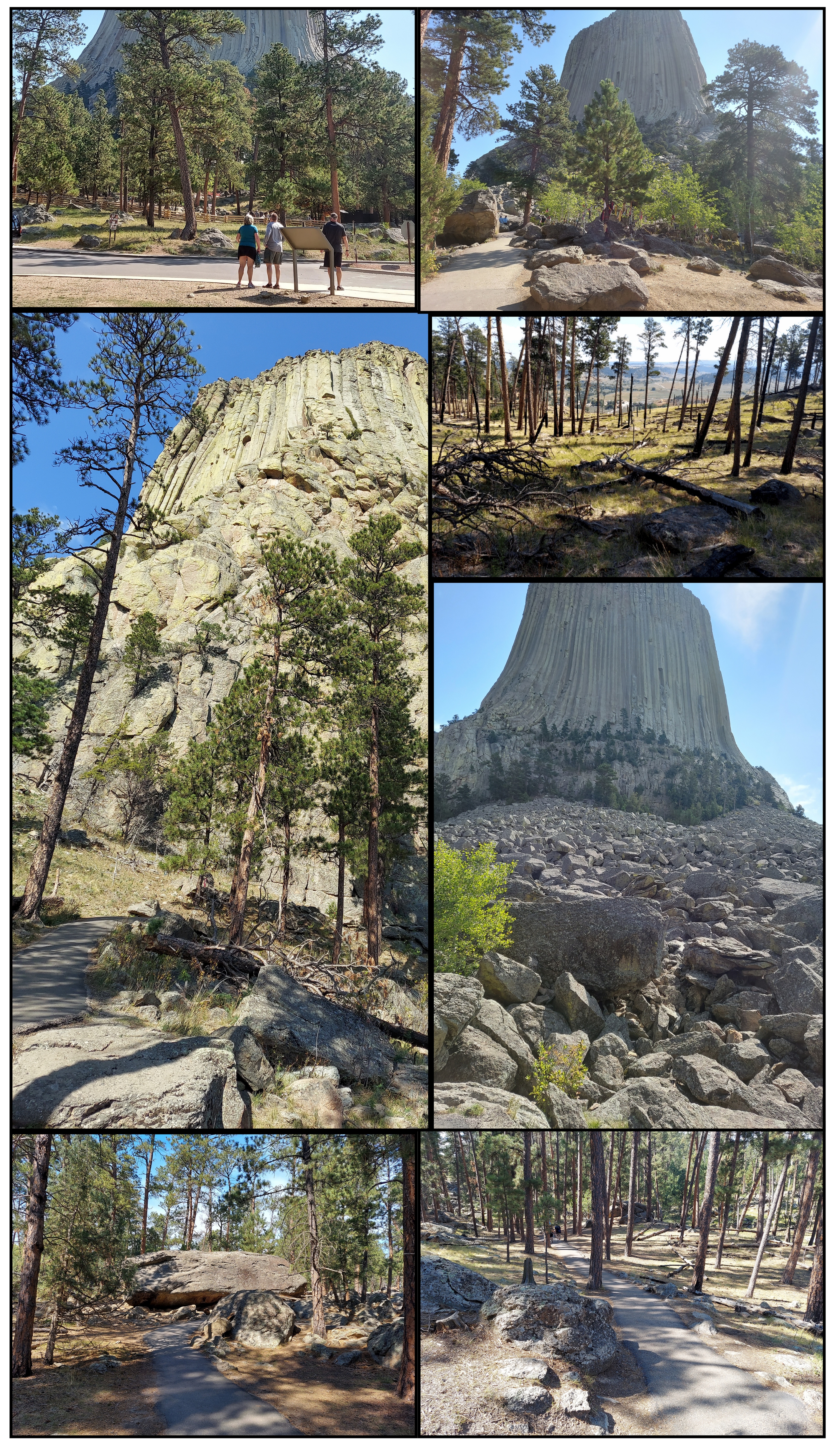
The Tower Tail is paved and disability accessible. The 1.3-mile trail which starts across the parking area from the visitor center, with a moderate elevation change. A short, steep section leads to you a junction that you can take either way to walk around the base of the Tower. Native Americans will only walk the Tower Trail clockwise. As you walk the Tower Trail you’ll see small bundles of cloths attached to the trees. These are Native American prayer cloths representing their spiritual connection with the Tower. I respected their beliefs and did not even photograph these prayer cloths.
The Tower Trail offers close-up views of the Tower, boulder fields, as well as sweeping views of the surrounding landscape. There are several benches to rest along the Tower Trail, as well as detailed signs which tell about the natural and cultural history of the park.
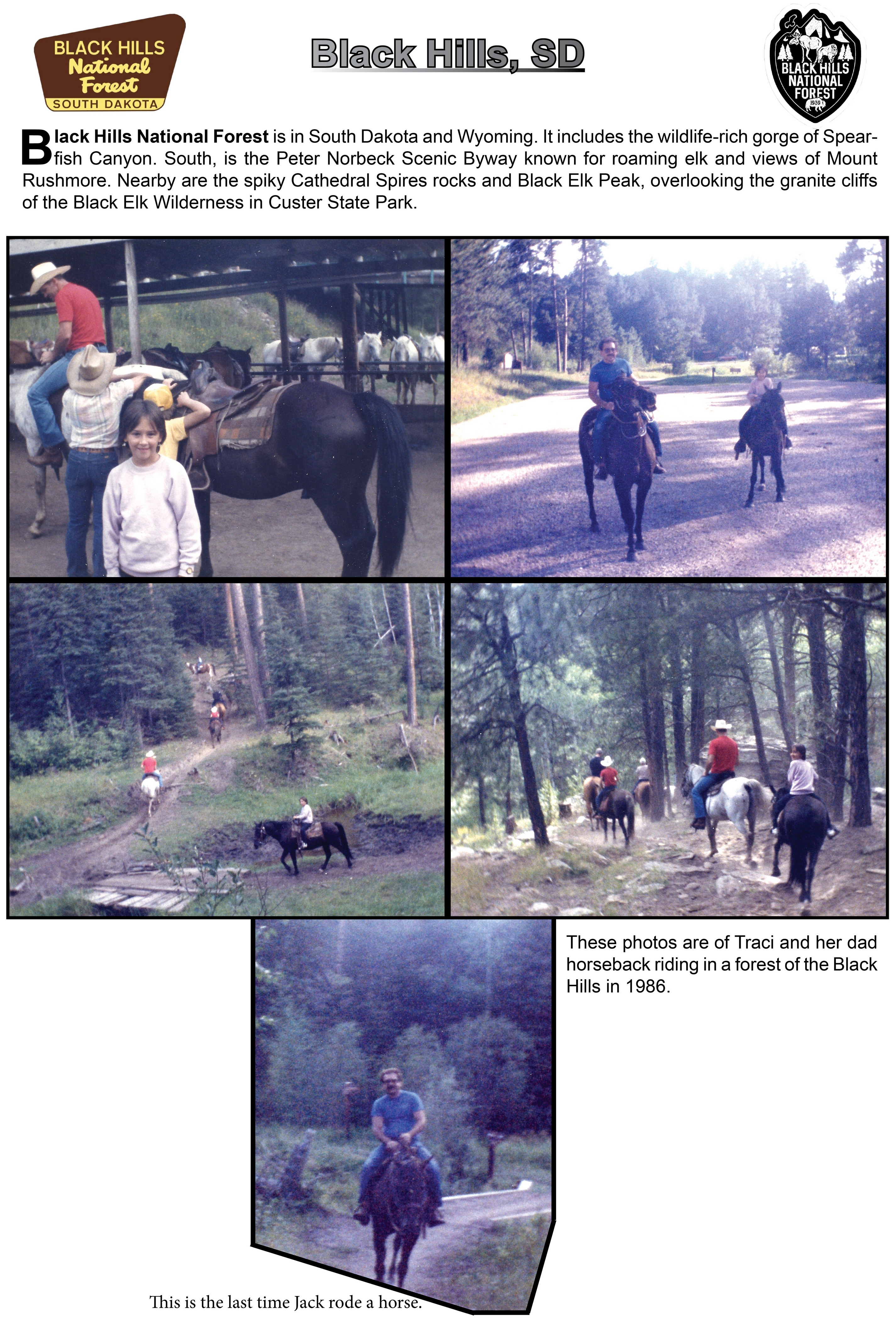
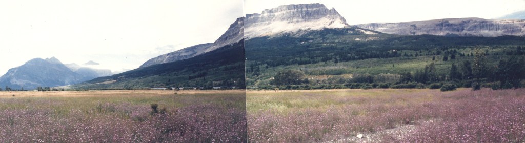
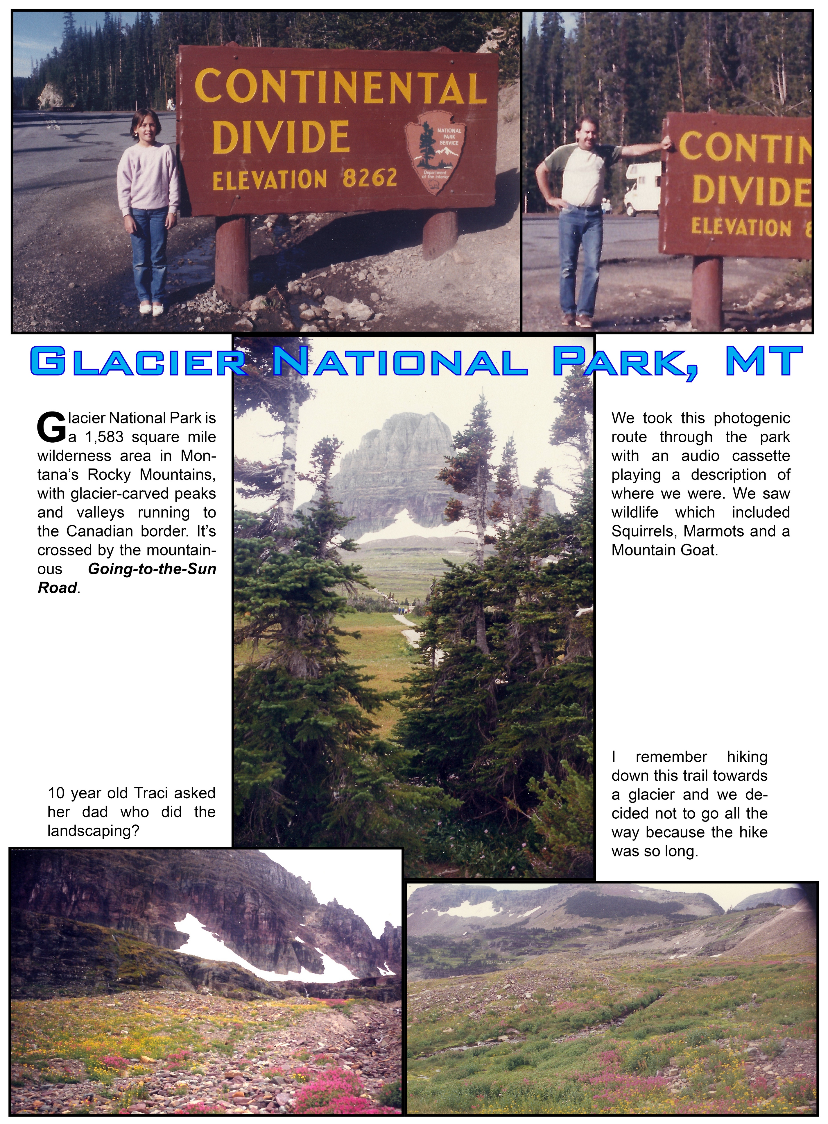
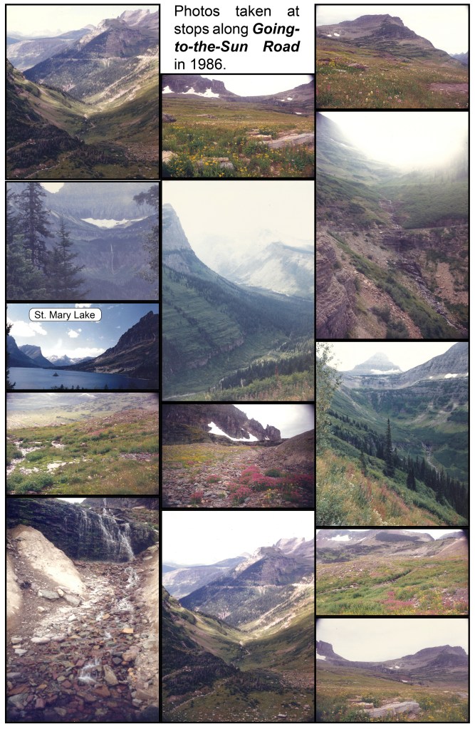
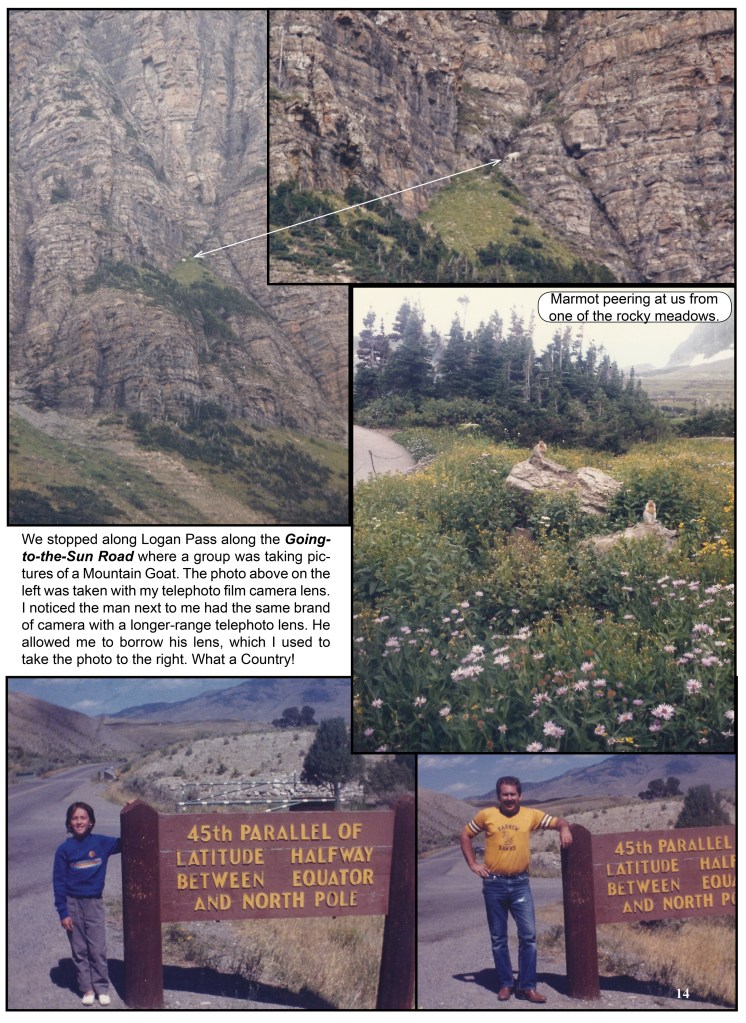
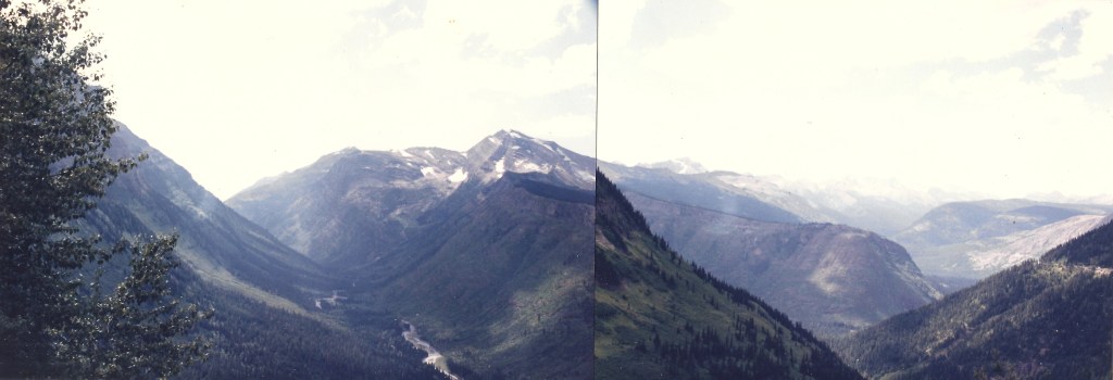
In August,1986, 10 year old Traci and her dad experience Glacier’s pristine forests, alpine meadows, rugged mountains, and spectacular lakes. We drove along the famous Going-to-the-Sun Road, listening to an audio cassette describing our stops of the Glacier National Park.